|
search place name
|
||
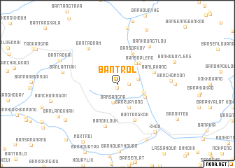
Ban Trol (Laos)Ban Trol is a town in Laos. An overview map of the region around Ban Trol is displayed below.
regional and 3d topo map of Ban Trol, Laos ::
Ban Trol airports ::
The nearest airport is LPQ - Luang Prabang Luang Phabang Intl, located 141.9 km south of Ban Trol.
Nearby towns ::
Ban Tlôn (0.6km south) //
Thang Kla (1.7km east) //
Ban Sang-Na (3.0km south) //
Ban Hadum (3.1km east) //
Ban Rua Yong (4.1km south east) //
Ban Houaylik (4.1km east) //
Ban Houayphôn (4.3km north east) //
Ban Houayphè (4.5km south east) //
Ban Sôplèng (4.7km north east) //
Ban Sôpxoy (5.3km north east) //
Ban Lahang (5.7km east) //
Ban Tangkôk (6.3km south east) //
Ban Omlouk (7.0km south) //
Ban Taonam (7.2km north west) //
Ban Koungtlou (7.6km north east) //
Ban Chomxôn (7.9km east) //
Ban Lantiak (8.3km west) //
Ban Houayphouk (9.0km north) //
Khoa (9.5km south east) //
Ban Sènngeun (9.7km north east) //
Ban Phônkang (9.8km south east) //
Ban Houaysèn (9.7km south west) //
[all distances 'as the bird flies' and approximate]  Places with similar names to Ban Trol, Laos ::
// Boone Trail (US)
// Bonetraill (US)
// Bondorola (BF)
// Banderilla (CR)
// Bandrāl (IN)
// Bandrāli (IN)
// Bandroul (IN)
// Banderilla (MX)
// Boundourolo (ML)
// Bandrāl (PK)
Disclaimer :: Information on this page comes without warranty of any kind |
||
|
Where is Ban Trol? Elevation and coordinates ::
Latitude (lat): 21°9'0"N Longitude (lon): 102°27'0"E
Elevation (approx.): 869m (map arrows pan, magnifying glasses zoom) |
||
|
Visiting Ban Trol? Hotel/Accommodation ::
Book a hotel in Ban Trol Travel Guide ::
Buy a travel guide for Laos rental cars ::
car rental offers GPS waypoint ::
download a GPX waypoint (PoI) of Ban Trol for your GPS receiver
|
||