|
search place name
|
||
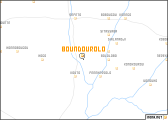
Boundourolo (Mali)Boundourolo is a town in Mali. An overview map of the region around Boundourolo is displayed below.
regional and 3d topo map of Boundourolo, Mali ::
Boundourolo airports ::
The nearest airport is KYS - Kayes Dag Dag, located 179.6 km west of Boundourolo.
Other airports nearby include BKO - Bamako Senou (261.4 km south east), Nearby towns ::
Bandiougoubougou (2.6km north west) //
Koni (4.0km north west) //
Kouta (4.1km south west) //
Féné Messala (5.2km south east) //
Balalaba (5.4km east) //
Balalani (5.7km east) //
Fantabougou (7.4km east) //
Sitassaba (7.7km north east) //
Dialamadji (8.1km north east) //
[all distances 'as the bird flies' and approximate]  Places with similar names to Boundourolo, Mali ::
// Boone Trail (US)
// Bonetraill (US)
// Bondorola (BF)
// Banderilla (CR)
// Bandrāl (IN)
// Bandrāli (IN)
// Bandroul (IN)
// Banderilla (MX)
// Ban Trol (LA)
// Bandrāl (PK)
Disclaimer :: Information on this page comes without warranty of any kind |
||
|
Where is Boundourolo? Elevation and coordinates ::
Latitude (lat): 14°3'0"N Longitude (lon): 9°48'0"W
Elevation (approx.): 236m (map arrows pan, magnifying glasses zoom) |
||
|
Visiting Boundourolo? Hotel/Accommodation ::
Book a hotel in Boundourolo Travel Guide ::
Buy a travel guide for Mali rental cars ::
car rental offers GPS waypoint ::
download a GPX waypoint (PoI) of Boundourolo for your GPS receiver
|
||