|
search place name
|
||
Baniakafata (Mali)Baniakafata is a town in Mali. An overview map of the region around Baniakafata is displayed below.
regional and 3d topo map of Baniakafata, Mali ::

Baniakafata airports ::
The nearest airport is BKO - Bamako Senou, located 203.7 km east of Baniakafata.
Other airports nearby include KYS - Kayes Dag Dag (251.7 km north west), Nearby towns ::
Sibidinnkili (2.6km south west) //
Guéniféto (3.6km west) //
Niokolo (4.1km south east) //
Banhon (5.2km north west) //
Baniankafata (5.6km north) //
Bougaribaya (5.7km west) //
Kéniékéniéko (5.8km south) //
Kobéa (8.1km south east) //
Biliko (9.1km north west) //
Guénibafé (9.2km north west) //
[all distances 'as the bird flies' and approximate] 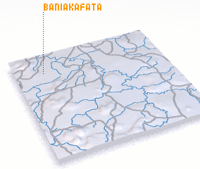 Places with similar names to Baniakafata, Mali ::
// Ban Ko Pho (3) (TH)
// Ban Ku Phadu (TH)
// Bān Nokhvod (IR)
// Bena-Kafutu (CD)
// Bangoufida (NE)
// Ban Kava Tai (LA)
// Bangveti (GE)
// Bản Cò Fat (VN)
// Bankevid (SE)
// Bankfoot (GB)
Disclaimer :: Information on this page comes without warranty of any kind |
||
|
Where is Baniakafata? Elevation and coordinates ::
Latitude (lat): 12°50'0"N Longitude (lon): 9°48'0"W
Elevation (approx.): 332m (map arrows pan, magnifying glasses zoom) |
||
|
Visiting Baniakafata? Hotel/Accommodation ::
Book a hotel in Baniakafata Travel Guide ::
Buy a travel guide for Mali rental cars ::
car rental offers GPS waypoint ::
download a GPX waypoint (PoI) of Baniakafata for your GPS receiver
|
||