|
search place name
|
||
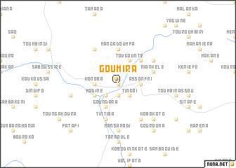
Goumira (Mali)Goumira is a town in Mali. An overview map of the region around Goumira is displayed below.
regional and 3d topo map of Goumira, Mali ::
Goumira airports ::
The nearest airport is KYS - Kayes Dag Dag, located 122.0 km west of Goumira.
Other airports nearby include SEY - Selibabi Selibady (234.0 km north west), KGG - Kedougou (262.7 km south west), Nearby towns ::
Yeri Malo (0.0km north) //
Madina (1.9km south) //
Kofoulaté (2.6km south west) //
Tingoï (2.6km south east) //
Fassala (2.6km north east) //
Assonfri (3.6km east) //
Konoba (3.6km west) //
Diabougou (4.0km south west) //
Madiné (4.0km south west) //
Goundara (4.1km south west) //
Tougounté (4.1km north east) //
Kéniéba Koto (5.2km north east) //
Mangadoumfa (5.6km north) //
Tintiba (5.8km south) //
Niankélé (5.7km east) //
Fardala (6.6km south east) //
Kondora (6.6km north west) //
Bonka (6.5km north east) //
Mansamadi (7.4km south) //
Baladougou (7.4km west) //
Kobokoto (7.7km south east) //
Gourouma (9.2km south east) //
Fatafi (10.3km south west) //
[all distances 'as the bird flies' and approximate] 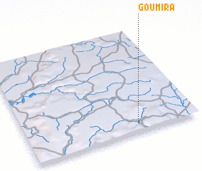 Places with similar names to Goumira, Mali ::
Disclaimer :: Information on this page comes without warranty of any kind |
||
|
Where is Goumira? Elevation and coordinates ::
Latitude (lat): 14°5'0"N Longitude (lon): 10°21'0"W
Elevation (approx.): 305m (map arrows pan, magnifying glasses zoom) |
||
|
Visiting Goumira? Hotel/Accommodation ::
Book a hotel in Goumira Travel Guide ::
Buy a travel guide for Mali rental cars ::
car rental offers GPS waypoint ::
download a GPX waypoint (PoI) of Goumira for your GPS receiver
|
||