|
search place name
|
||
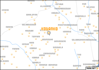
Kodanko (Koulikoro, Mali)Kodanko is a town in the Koulikoro region of Mali. An overview map of the region around Kodanko is displayed below.
regional and 3d topo map of Kodanko, Mali ::
Kodanko airports ::
The nearest airport is BKO - Bamako Senou, located 69.3 km north east of Kodanko.
Nearby towns ::
Siguimbili (2.0km north west) //
Namalé (2.6km west) //
Boungouma (2.7km south) //
Kamalo (2.8km north east) //
Kolènda (3.6km south) //
Landi (3.6km south west) //
Farabani (3.9km west) //
Bonfan (4.9km north east) //
Dankasséné (5.1km south east) //
Tonfara (5.3km west) //
Saramodola (5.8km south) //
Kimalé (5.9km east) //
Singouéla (6.4km south east) //
Bélindo (6.5km south west) //
Kananko (6.5km east) //
Faraguè (6.6km south) //
Falikabougou (6.8km north east) //
Koundian (6.9km north east) //
Sokourani (7.0km north west) //
Missifinkabougouda (7.3km north east) //
Madouba (7.5km west) //
Mourouba (7.6km north east) //
Mana (7.7km south west) //
Kaoualé (7.8km north) //
Bofé (7.7km west) //
Farakoundo (8.0km south) //
Darakondo (8.1km south) //
Bougoudalé (8.0km north west) //
Dioumamana (8.1km east) //
[all distances 'as the bird flies' and approximate] 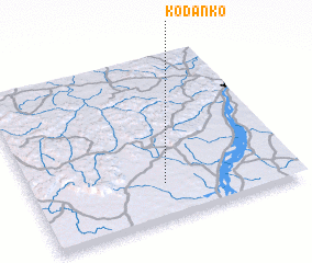 Places with similar names to Kodanko, Mali ::
Disclaimer :: Information on this page comes without warranty of any kind |
||
|
Where is Kodanko? Elevation and coordinates ::
Latitude (lat): 12°12'38"N Longitude (lon): 8°29'44"W
Elevation (approx.): 376m (map arrows pan, magnifying glasses zoom) |
||
|
Visiting Kodanko? Hotel/Accommodation ::
Book a hotel in Kodanko Travel Guide ::
Buy a travel guide for Mali rental cars ::
car rental offers GPS waypoint ::
download a GPX waypoint (PoI) of Kodanko for your GPS receiver
|
||