|
search place name
|
||
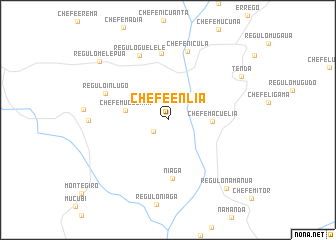
Chefe Enlia (Zambézia, Mozambique)Chefe Enlia is a town in the Zambézia region of Mozambique. An overview map of the region around Chefe Enlia is displayed below.
regional and 3d topo map of Chefe Enlia, Mozambique ::
Chefe Enlia airports ::
The nearest airport is UEL - Quelimane, located 191.2 km south of Chefe Enlia.
Nearby towns ::
Chefe Erema (2.0km south west) //
Chefe Muculama (4.7km west) //
Chefe Macuelia (4.8km east) //
Niaga (6.6km south) //
Guelele (7.5km north) //
Régulo Inlugo (7.3km north west) //
Regulo Guelele (7.8km north west) //
Chefe Nicula (7.9km north) //
Inlugo (8.5km west) //
Tenda (9.3km north east) //
Regulo Melepua (9.8km north west) //
Régulo Namanua (9.9km south east) //
[all distances 'as the bird flies' and approximate] 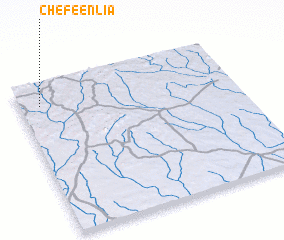 Places with similar names to Chefe Enlia, Mozambique ::
// Choghānlū (IR)
// Chavinillo (PE)
// Chefe Neuala (MZ)
// Chefe Neuela (MZ)
// Chefe Unla (MZ)
// Chifinele (MZ)
// Shifnal (GB)
// Hsiao-fan-li (TW)
// Shih-fen-liao (TW)
// Chavanol (FR)
Disclaimer :: Information on this page comes without warranty of any kind |
||
|
Where is Chefe Enlia? Elevation and coordinates ::
Latitude (lat): 16°8'29"S Longitude (lon): 37°5'47"E
Elevation (approx.): 377m (map arrows pan, magnifying glasses zoom) |
||
|
Visiting Chefe Enlia? Hotel/Accommodation ::
Book a hotel in Chefe Enlia Travel Guide ::
Buy a travel guide for Mozambique rental cars ::
car rental offers GPS waypoint ::
download a GPX waypoint (PoI) of Chefe Enlia for your GPS receiver
|
||