|
search place name
|
||
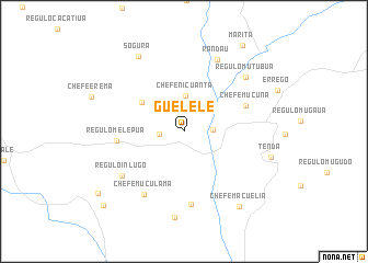
Guelele (Zambézia, Mozambique)Guelele is a town in the Zambézia region of Mozambique. An overview map of the region around Guelele is displayed below.
regional and 3d topo map of Guelele, Mozambique ::
Guelele airports ::
The nearest airport is UEL - Quelimane, located 198.5 km south of Guelele.
Nearby towns ::
Regulo Guelele (2.4km west) //
Chefe Nicula (2.8km east) //
Chefe Nicuanta (3.6km north) //
Chefe Madia (5.0km north west) //
Chefe Mucuna (6.6km north east) //
Regulo Melepua (6.7km west) //
Chefe Enlia (7.5km south) //
Chefe Muculama (7.5km south west) //
Régulo Inlugo (7.5km south west) //
Randau (8.0km north east) //
Régulo Mutubua (8.2km north east) //
Chefe Erema (8.8km south) //
Sogura (8.8km north west) //
Tenda (8.9km east) //
Chefe Macuelia (9.4km south east) //
Marita (10.5km north east) //
Chefe Insaquela (10.5km south west) //
Inlugo (10.9km south west) //
[all distances 'as the bird flies' and approximate] 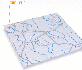 Places with similar names to Guelele, Mozambique ::
Disclaimer :: Information on this page comes without warranty of any kind |
||
|
Where is Guelele? Elevation and coordinates ::
Latitude (lat): 16°4'27"S Longitude (lon): 37°5'25"E
Elevation (approx.): 454m (map arrows pan, magnifying glasses zoom) |
||
|
Visiting Guelele? Hotel/Accommodation ::
Book a hotel in Guelele Travel Guide ::
Buy a travel guide for Mozambique rental cars ::
car rental offers GPS waypoint ::
download a GPX waypoint (PoI) of Guelele for your GPS receiver
|
||