|
search place name
|
||
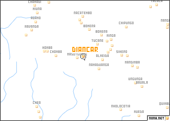
Diancar (Cabo Delgado, Mozambique)Diancar is a town in the Cabo Delgado region of Mozambique. An overview map of the region around Diancar is displayed below.
regional and 3d topo map of Diancar, Mozambique ::
Diancar airports ::
The nearest airport is MZB - Mocimboa Da Praia, located 101.7 km east of Diancar.
Other airports nearby include MYW - Mtwara (156.7 km north east), POL - Pemba (197.4 km south east), Nearby towns ::
Masutguane (1.8km west) //
Namaduanga (3.6km south east) //
Almeida (3.8km east) //
Tucane (4.5km north east) //
Singo (5.4km east) //
Micongo (6.0km north east) //
Chomba (6.3km west) //
Miula (6.4km north east) //
Bomera (6.6km north east) //
Bomera (6.9km north) //
Cuntamulungo (6.8km north east) //
Minga (7.3km north east) //
Sihepo (8.1km east) //
Mandjeda (8.3km north) //
Homba (8.3km west) //
Chikalango (9.0km north) //
[all distances 'as the bird flies' and approximate] 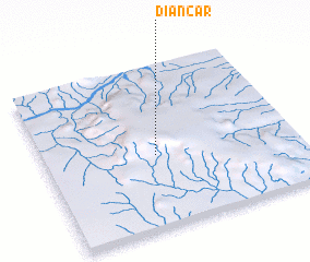 Places with similar names to Diancar, Mozambique ::
Disclaimer :: Information on this page comes without warranty of any kind |
||
|
Where is Diancar? Elevation and coordinates ::
Latitude (lat): 11°33'10"S Longitude (lon): 39°26'34"E
Elevation (approx.): 966m (map arrows pan, magnifying glasses zoom) |
||
|
Visiting Diancar? Hotel/Accommodation ::
Book a hotel in Diancar Travel Guide ::
Buy a travel guide for Mozambique rental cars ::
car rental offers GPS waypoint ::
download a GPX waypoint (PoI) of Diancar for your GPS receiver
|
||