|
search place name
|
||
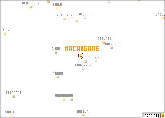
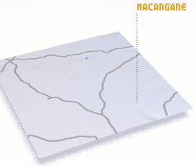
Macangane (Inhambane, Mozambique)Macangane is a town in the Inhambane region of Mozambique. An overview map of the region around Macangane is displayed below.
regional and 3d topo map of Macangane, Mozambique ::
Macangane airports ::
The nearest airport is VNX - Vilankulu Vilankulo, located 101.6 km north east of Macangane.
Other airports nearby include INH - Inhambane (141.1 km south east), Nearby towns ::
 Places with similar names to Macangane, Mozambique ::
// Maconacon (PH)
// Magungunay (PH)
// Makongani (KE)
// Mkongani (KE)
// Mkunguni (KE)
// Mukunguni (KE)
// Makangonio (GA)
// Mukangani (ZM)
// Makongoni (TZ)
// Mgongoni (TZ)
Disclaimer :: Information on this page comes without warranty of any kind |
||
|
Where is Macangane? Elevation and coordinates ::
Latitude (lat): 22°45'48"S Longitude (lon): 34°44'15"E
Elevation (approx.): 126m (map arrows pan, magnifying glasses zoom) |
||
|
Visiting Macangane? Hotel/Accommodation ::
Book a hotel in Macangane Travel Guide ::
Buy a travel guide for Mozambique rental cars ::
car rental offers GPS waypoint ::
download a GPX waypoint (PoI) of Macangane for your GPS receiver
|
||