|
search place name
|
||
Dhumey (Bay, Somalia)Dhumey is a town in the Bay region of Somalia. An overview map of the region around Dhumey is displayed below.
regional and 3d topo map of Dhumey, Somalia ::
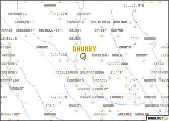
Nearby towns ::
Magaay Muuse (1.9km north) //
Aw Jiloole (1.9km south) //
Bog Daadi (1.9km west) //
Kormarey (2.6km north east) //
Moroligoy (3.7km east) //
Qadiidle Xarey (3.7km west) //
Galbow (4.1km north west) //
Salam Maroodi (4.1km south east) //
Habay Gare (4.1km south west) //
Rooble Shiikh (5.2km south west) //
Kuunyada Boodh (5.2km south west) //
Qadiidle (5.6km west) //
Qurunlow (5.6km west) //
Galboy (5.9km north) //
Lugabaro (5.9km south) //
Gamber (6.7km north east) //
Wagadoy (6.7km south east) //
Kuuniyo (6.7km south east) //
Aawla (7.4km east) //
Mintaal Amiin (7.4km east) //
Aborko (7.4km south) //
Samakaya (7.6km north) //
Mada Baroodi (7.6km east) //
Mintalamiin (8.3km north east) //
Loowiloy (8.3km south east) //
Silaata (8.3km south east) //
Munyow (9.3km north east) //
Galool Dheer (9.3km north west) //
[all distances 'as the bird flies' and approximate] 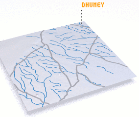 Places with similar names to Dhumey, Somalia ::
Disclaimer :: Information on this page comes without warranty of any kind |
||
|
Where is Dhumey? Elevation and coordinates ::
Latitude (lat): 2°58'0"N Longitude (lon): 43°57'0"E
Elevation (approx.): 253m (map arrows pan, magnifying glasses zoom) |
||
|
Visiting Dhumey? Hotel/Accommodation ::
Book a hotel in Dhumey Travel Guide ::
Buy a travel guide for Somalia rental cars ::
car rental offers GPS waypoint ::
download a GPX waypoint (PoI) of Dhumey for your GPS receiver
|
||