|
search place name
|
||
Qaranka (Bay, Somalia)Qaranka is a town in the Bay region of Somalia. An overview map of the region around Qaranka is displayed below.
regional and 3d topo map of Qaranka, Somalia ::
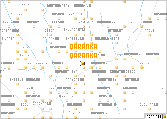
Nearby towns ::
Aw Kuulaw (1.9km east) //
Qaranka (1.9km south) //
Galgalow (1.9km south) //
Duura (2.6km north east) //
Degdaa (2.6km south east) //
Guudka (2.6km north west) //
Shan Hagar (3.7km south) //
Balaaw (3.7km south) //
Gaal Guuris (3.7km north) //
Hooday (3.7km north) //
Wartaa (3.7km east) //
Heer Caliyow Mamow (4.1km north east) //
Galgalow (4.1km south west) //
Shabeelle (4.1km north west) //
Korey (4.1km north west) //
Heer Isaaq (4.1km north east) //
Aw Daarow (4.1km south east) //
Heer Faqi (4.1km north east) //
Gadiisey (4.1km north west) //
Hoogey (4.1km south west) //
Ugaarow (5.2km south east) //
Kuunyo (5.2km south east) //
Wafdhey Weyn (5.2km south west) //
Malaayka (5.2km north west) //
Misnagate (5.2km north west) //
Kiyaan (5.6km south) //
Meykoofuurey (5.6km north) //
Idaadlow Mataakooy (5.6km north) //
Heer Aw Madow (5.6km north) //
[all distances 'as the bird flies' and approximate] 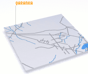 Places with similar names to Qaranka, Somalia ::
Disclaimer :: Information on this page comes without warranty of any kind |
||
|
Where is Qaranka? Elevation and coordinates ::
Latitude (lat): 2°54'0"N Longitude (lon): 44°10'0"E
Elevation (approx.): 224m (map arrows pan, magnifying glasses zoom) |
||
|
Visiting Qaranka? Hotel/Accommodation ::
Book a hotel in Qaranka Travel Guide ::
Buy a travel guide for Somalia rental cars ::
car rental offers GPS waypoint ::
download a GPX waypoint (PoI) of Qaranka for your GPS receiver
|
||