|
search place name
|
||
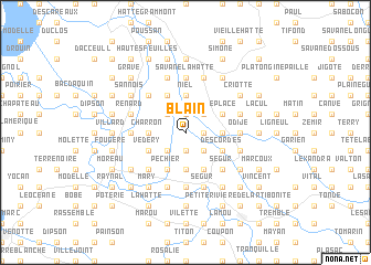
Blain (Artibonite, Haiti)Blain is a town in the Artibonite region of Haiti. An overview map of the region around Blain is displayed below.
regional and 3d topo map of Blain, Haiti ::
Blain airports ::
The nearest airport is CAP - Cap Haitien Intl, located 68.9 km north east of Blain.
Other airports nearby include PAP - Port-au-prince Toussaint Louverture Intl (73.2 km south), BRX - Barahona Maria Montez Intl (182.3 km south east), STI - Santiago Cibao Intl (204.0 km east), POP - Puerto Plata Gregorio Luperon Intl (215.2 km east), Nearby towns ::
Coutant (1.8km east) //
Barage (1.8km east) //
Dupitraye (1.9km south) //
Delauné (1.9km south) //
LʼAbbé (1.9km south) //
Vannos (1.9km north) //
La Ville (2.5km south east) //
Dutreuille (2.5km south east) //
Brulin (2.5km south east) //
Désile (2.5km south east) //
Carrefour Ti Bois (2.5km north east) //
Ville Petite Place (2.5km north east) //
LʼÉtang (2.5km south west) //
Jean Denis (2.5km south west) //
Boulin (2.5km south west) //
Legriel (2.5km south west) //
La Couture (2.5km north west) //
Bérard (2.5km north west) //
Brissard (2.5km north west) //
Bertrand (2.5km north west) //
Jour (3.5km east) //
Bois La Ville (3.7km south) //
Neveu (3.7km south) //
Niel (3.7km north) //
Perrembeau (3.5km west) //
Charron (3.5km west) //
Beaufort (3.5km west) //
Laville (4.1km south east) //
Delauné (4.1km south east) //
[all distances 'as the bird flies' and approximate] 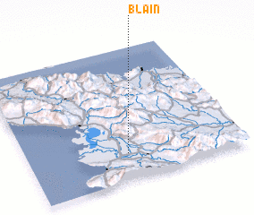 Places with similar names to Blain, Haiti ::
Disclaimer :: Information on this page comes without warranty of any kind |
||
|
Where is Blain? Elevation and coordinates ::
Latitude (lat): 19°12'0"N Longitude (lon): 72°32'0"W
Elevation (approx.): 14m (map arrows pan, magnifying glasses zoom) |
||
|
Visiting Blain? Hotel/Accommodation ::
Book a hotel in Blain Travel Guide ::
Buy a travel guide for Haiti rental cars ::
car rental offers GPS waypoint ::
download a GPX waypoint (PoI) of Blain for your GPS receiver
|
||