|
search place name
|
||
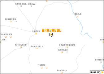
Dan Zabou (Maradi, Niger)Dan Zabou is a town in the Maradi region of Niger. An overview map of the region around Dan Zabou is displayed below.
regional and 3d topo map of Dan Zabou, Niger ::
Dan Zabou airports ::
The nearest airport is MFG - Maradi, located 115.3 km south of Dan Zabou.
Other airports nearby include THZ - Tahoua (172.2 km west), SKO - Sokoto Sadiq Abubakar Iii Intl (247.0 km south west), Nearby towns ::
Dakoro (5.7km west) //
Fadama Rakouma (6.5km south east) //
Tagamaoua (6.6km south east) //
Birnin Lallé (6.8km south west) //
Maya (7.7km south east) //
[all distances 'as the bird flies' and approximate] 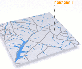 Places with similar names to Dan Zabou, Niger ::
// Tanzybey (RU)
// Dunsub (PH)
// Dansby (US)
// Dan Zabia (NE)
// Dan Zabo (NE)
// Dan Zabo (NE)
// Dan Sabo (NG)
// Dan Zabia (NG)
// Ti-n-Azabo (ML)
// Dona Eusébia (BR)
Disclaimer :: Information on this page comes without warranty of any kind |
||
|
Where is Dan Zabou? Elevation and coordinates ::
Latitude (lat): 14°30'0"N Longitude (lon): 6°49'0"E
Elevation (approx.): 444m (map arrows pan, magnifying glasses zoom) |
||
|
Visiting Dan Zabou? Hotel/Accommodation ::
Book a hotel in Dan Zabou Travel Guide ::
Buy a travel guide for Niger rental cars ::
car rental offers GPS waypoint ::
download a GPX waypoint (PoI) of Dan Zabou for your GPS receiver
|
||