|
search place name
|
||
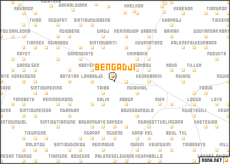
Bengadji (Louga, Senegal)Bengadji is a town in the Louga region of Senegal. An overview map of the region around Bengadji is displayed below.
regional and 3d topo map of Bengadji, Senegal ::
Bengadji airports ::
The nearest airport is XLS - St. Louis Saint Louis, located 46.5 km north of Bengadji.
Other airports nearby include DKR - Dakar Leopold Sedar Senghor Intl (160.0 km south west), KLC - Kaolack (169.1 km south), Nearby towns ::
Khelkom (1.8km east) //
Taïba (2.6km south west) //
Lambadjé (3.6km west) //
Mboup (4.1km south east) //
Ndiakhal (4.0km south east) //
Keur Kora (4.0km south east) //
Keur Sambou (4.0km north east) //
Salim (4.1km south west) //
Mbaye Mbaye (4.0km north west) //
Khimbakh (5.1km north east) //
Khelkom (5.1km south west) //
Keur Mbarik (5.4km east) //
Sine Ouad (5.8km north) //
Sintiou Baïti (5.8km north) //
Keur Médou (5.7km east) //
Same Ndiaye (6.5km north west) //
Boussourou Lo (6.6km south east) //
Khambala (6.5km north east) //
Niandoul (6.6km north west) //
Baye Yar (7.1km west) //
Sam Sek (7.4km south) //
Mérina Diop (7.6km north) //
Nguèyène (7.6km south) //
Maka Ndiaye (7.4km west) //
Diadj (7.6km north) //
Kourtara (7.6km south) //
Keur Mayoro (7.7km north east) //
Mérina Santié (7.7km north west) //
Nièm (8.0km south east) //
[all distances 'as the bird flies' and approximate] 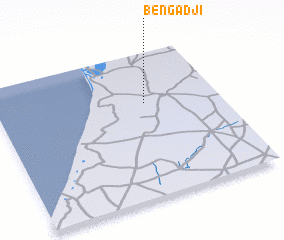
Disclaimer :: Information on this page comes without warranty of any kind |
||
|
Where is Bengadji? Elevation and coordinates ::
Latitude (lat): 15°39'0"N Longitude (lon): 16°20'0"W
Elevation (approx.): 33m (map arrows pan, magnifying glasses zoom) |
||
|
Visiting Bengadji? Hotel/Accommodation ::
Book a hotel in Bengadji Travel Guide ::
Buy a travel guide for Senegal rental cars ::
car rental offers GPS waypoint ::
download a GPX waypoint (PoI) of Bengadji for your GPS receiver
|
||