|
search place name
|
||
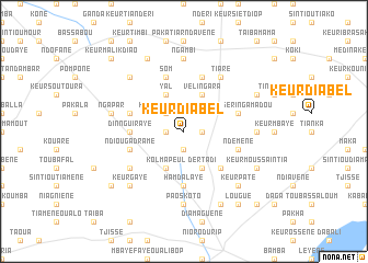
Keur Diabel (Kaolack, Senegal)Keur Diabel is a town in the Kaolack region of Senegal. An overview map of the region around Keur Diabel is displayed below.
regional and 3d topo map of Keur Diabel, Senegal ::
Keur Diabel airports ::
The nearest airport is KLC - Kaolack, located 41.5 km north west of Keur Diabel.
Other airports nearby include BJL - Banjul Intl (106.7 km south west), ZIG - Ziguinchor (151.8 km south), CSK - Cap Skiring (188.5 km south west), DKR - Dakar Leopold Sedar Senghor Intl (205.7 km north west), Nearby towns ::
Keur Gamon (1.8km west) //
Keur Bandiougou (1.9km south) //
Dionvelli (1.8km east) //
Keur Saafatime (2.6km north west) //
Kolma Peul (4.1km south west) //
Yal (4.1km north west) //
Dertadi (4.1km south east) //
Darou Mousti (4.1km north east) //
Vélingara (4.1km north east) //
Bouboudième (5.2km south east) //
Hamdalaye (5.6km south) //
Dinnguiraye (5.4km west) //
Som (5.8km north) //
Keur Bara (5.7km west) //
Ndiouga Dramé (5.7km west) //
Keur Séring Amadou (5.7km east) //
Darou Baïla (5.8km north) //
Ndémène (5.7km east) //
Kolma Diordior (6.5km south west) //
Tiaré (6.6km north east) //
Paoskoto (7.4km south) //
Ngambi (7.4km north) //
Daro Koudous (7.2km east) //
Ngapar (7.4km west) //
Keur Gaye (7.7km south west) //
Dafar (7.7km south west) //
Keur Séring Oumar Ndao (7.7km north west) //
Keur Paté (7.7km south east) //
Barkjéwèl (7.7km south east) //
[all distances 'as the bird flies' and approximate]  Places with similar names to Keur Diabel, Senegal ::
// Cardabello (IT)
// Courtableau (US)
// Gartabal (IN)
// Keur Diabel (SN)
// Keur Diabel (SN)
// Keur Diabèl (SN)
// Keur Diâbél (SN)
// Gūrīd-e Bālā (IR)
// Kahrūd-e Bālā (IR)
// Ker Dobaly (GM)
Disclaimer :: Information on this page comes without warranty of any kind |
||
|
Where is Keur Diabel? Elevation and coordinates ::
Latitude (lat): 13°51'0"N Longitude (lon): 15°49'0"W
Elevation (approx.): 21m (map arrows pan, magnifying glasses zoom) |
||
|
Visiting Keur Diabel? Hotel/Accommodation ::
Book a hotel in Keur Diabel Travel Guide ::
Buy a travel guide for Senegal rental cars ::
car rental offers GPS waypoint ::
download a GPX waypoint (PoI) of Keur Diabel for your GPS receiver
|
||