|
search place name
|
||
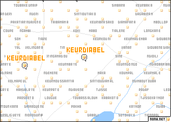
Keur Diabel (Kaolack, Senegal)Keur Diabel is a town in the Kaolack region of Senegal. An overview map of the region around Keur Diabel is displayed below.
regional and 3d topo map of Keur Diabel, Senegal ::
Keur Diabel airports ::
The nearest airport is KLC - Kaolack, located 49.0 km north west of Keur Diabel.
Other airports nearby include BJL - Banjul Intl (118.5 km south west), ZIG - Ziguinchor (158.2 km south west), CSK - Cap Skiring (197.0 km south west), DKR - Dakar Leopold Sedar Senghor Intl (216.0 km north west), Nearby towns ::
Tianka (1.9km south) //
Keur Saafadi (1.8km west) //
Kassas (2.6km north east) //
Tianga Keur Séring Layène (2.6km north west) //
Keur Al Adji Mamat Aoua (3.7km north) //
Tinndoye (4.0km north west) //
Keur Mbaye (4.0km south west) //
Keur Kouni (5.2km north east) //
Maka (5.2km south east) //
Ndama (5.6km south) //
Keur Mandaye (5.7km west) //
Koki (5.8km north) //
Daro Koudous (5.7km west) //
Mabo (5.8km north) //
Sintiou Diamal (6.6km south east) //
Kéroual (6.6km north west) //
Diokoul (6.5km south east) //
Sine (7.2km east) //
Keur Séring Amadou (7.2km west) //
Keur Mamout (7.6km north) //
Sintiou Vanar (7.4km east) //
Ndiavène (7.6km south) //
Médina Keur Babou (7.7km north east) //
Keur Moussa Intia (7.7km south west) //
Keur Ibra Sako (8.2km north east) //
Malène (8.2km north west) //
Tjissé (8.2km south east) //
Samba Siré (8.2km south east) //
Ndémène (8.1km south west) //
[all distances 'as the bird flies' and approximate]  Places with similar names to Keur Diabel, Senegal ::
// Cardabello (IT)
// Courtableau (US)
// Gartabal (IN)
// Keur Diabel (SN)
// Keur Diabel (SN)
// Keur Diabèl (SN)
// Keur Diâbél (SN)
// Gūrīd-e Bālā (IR)
// Kahrūd-e Bālā (IR)
// Ker Dobaly (GM)
Disclaimer :: Information on this page comes without warranty of any kind |
||
|
Where is Keur Diabel? Elevation and coordinates ::
Latitude (lat): 13°52'0"N Longitude (lon): 15°42'0"W
Elevation (approx.): 39m (map arrows pan, magnifying glasses zoom) |
||
|
Visiting Keur Diabel? Hotel/Accommodation ::
Book a hotel in Keur Diabel Travel Guide ::
Buy a travel guide for Senegal rental cars ::
car rental offers GPS waypoint ::
download a GPX waypoint (PoI) of Keur Diabel for your GPS receiver
|
||