|
search place name
|
||
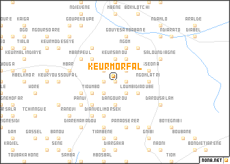
Keur Morfal (Fatick, Senegal)Keur Morfal is a town in the Fatick region of Senegal. An overview map of the region around Keur Morfal is displayed below.
regional and 3d topo map of Keur Morfal, Senegal ::
Keur Morfal airports ::
The nearest airport is KLC - Kaolack, located 55.8 km south west of Keur Morfal.
Other airports nearby include BJL - Banjul Intl (166.1 km south west), XLS - St. Louis Saint Louis (188.5 km north west), DKR - Dakar Leopold Sedar Senghor Intl (194.4 km west), ZIG - Ziguinchor (225.9 km south), Nearby towns ::
Ndiayène (0.0km north) //
Darou Pal (1.8km east) //
Naye Boyal (1.8km west) //
Barbaouane (2.6km north west) //
Keur Mamadou Ouguel (2.6km north east) //
Keur Ibrata (2.6km south east) //
Dara (2.6km south west) //
Mbaye (2.6km south west) //
Djéné (2.6km south west) //
Keur Sanou (3.7km north) //
Dangourou (3.7km south) //
Loumbi Diaoubé (4.0km south east) //
Keur Sabatine (4.1km north east) //
Tioumbo (4.0km south west) //
Déguère (5.2km north west) //
Dianvéli Alassane (5.2km south west) //
Ngom Latri (5.4km east) //
Nesséona (5.7km east) //
Keur Diégane (5.8km north) //
Dam Touré (5.7km west) //
Dianvéli Morsek (5.8km south) //
Ngom (5.8km north) //
Dara Idi (6.6km north east) //
Aye Noumane (6.6km south west) //
Djené (6.5km north west) //
Bountou Mbar (6.6km north west) //
Mbar Peul (6.5km north west) //
Panui (6.5km south west) //
Gouye Sambabane (7.6km north) //
[all distances 'as the bird flies' and approximate]  Places with similar names to Keur Morfal, Senegal ::
Disclaimer :: Information on this page comes without warranty of any kind |
||
|
Where is Keur Morfal? Elevation and coordinates ::
Latitude (lat): 14°31'0"N Longitude (lon): 15°42'0"W
Elevation (approx.): 39m (map arrows pan, magnifying glasses zoom) |
||
|
Visiting Keur Morfal? Hotel/Accommodation ::
Book a hotel in Keur Morfal Travel Guide ::
Buy a travel guide for Senegal rental cars ::
car rental offers GPS waypoint ::
download a GPX waypoint (PoI) of Keur Morfal for your GPS receiver
|
||