|
search place name
|
||
Keur Morfal (Thiès, Senegal)Keur Morfal is a town in the Thiès region of Senegal. An overview map of the region around Keur Morfal is displayed below.
regional and 3d topo map of Keur Morfal, Senegal ::

Keur Morfal airports ::
The nearest airport is DKR - Dakar Leopold Sedar Senghor Intl, located 80.3 km south west of Keur Morfal.
Other airports nearby include XLS - St. Louis Saint Louis (114.2 km north), KLC - Kaolack (133.5 km south east), BJL - Banjul Intl (194.1 km south), Nearby towns ::
Ngaye Diagne (0.0km north) //
Darou Khoudos (1.9km north) //
Gad Gomène (3.7km south) //
Ngarane II (4.0km south east) //
Ndiarhaté (4.0km north east) //
Mérina Fal (4.1km north east) //
Sintiou Ouakha (4.0km north west) //
Nass (4.1km north west) //
Merina Guèye (4.1km north west) //
Ndomor Diop (5.2km south west) //
Darou Moye (5.6km north) //
Peunène (5.6km north) //
Dialka (5.8km south) //
Ndamio (5.7km west) //
Tiamrouss (5.8km north) //
Dayamber (5.7km east) //
Timbora (6.6km south east) //
Taïba Ndiaye (6.5km south west) //
Mbaye Bakar (6.5km south east) //
Ndari (6.5km south east) //
Taïba Rhabe (6.6km south west) //
Keur Aliou Fal (6.5km north east) //
Mbaye Bayou (6.5km north west) //
Djigné (7.4km south) //
Méouane (7.2km east) //
Keur Gora Ndong (7.2km west) //
Keur Maguèye (7.6km south) //
Daf (7.6km south) //
Gati Tila (7.4km east) //
[all distances 'as the bird flies' and approximate] 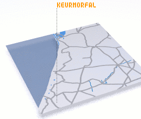 Places with similar names to Keur Morfal, Senegal ::
Disclaimer :: Information on this page comes without warranty of any kind |
||
|
Where is Keur Morfal? Elevation and coordinates ::
Latitude (lat): 15°5'0"N Longitude (lon): 16°50'0"W
Elevation (approx.): 49m (map arrows pan, magnifying glasses zoom) |
||
|
Visiting Keur Morfal? Hotel/Accommodation ::
Book a hotel in Keur Morfal Travel Guide ::
Buy a travel guide for Senegal rental cars ::
car rental offers GPS waypoint ::
download a GPX waypoint (PoI) of Keur Morfal for your GPS receiver
|
||