|
search place name
|
||
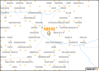
Mbène (Fatick, Senegal)Mbène is a town in the Fatick region of Senegal. An overview map of the region around Mbène is displayed below.
regional and 3d topo map of Mbène, Senegal ::
Mbène airports ::
The nearest airport is KLC - Kaolack, located 64.3 km south west of Mbène.
Other airports nearby include BJL - Banjul Intl (174.9 km south west), XLS - St. Louis Saint Louis (178.6 km north west), DKR - Dakar Leopold Sedar Senghor Intl (193.3 km west), Nearby towns ::
Tchissé Keur Mor (1.9km north) //
Boki Lotchi (3.6km east) //
Kolobane (4.1km north west) //
Gouye Sambabane (4.1km south east) //
Tchissé Modou Kossas (5.2km north east) //
Sangari (5.2km north west) //
Ndiévène (5.4km west) //
Badiane Nèm (5.4km west) //
Tchissé Keur Amar Rhoulé (5.7km east) //
Sanari (5.7km west) //
Keur Diégane (5.8km south) //
Ngom (5.8km south) //
Goupé Koupé (5.7km west) //
Dara Idi (6.6km south east) //
Lévé (6.5km north east) //
Bountou Mbar (6.6km south west) //
Ndiène (6.6km north east) //
Bané (6.6km north east) //
Mbayène (6.6km north east) //
Diavène (6.5km north west) //
Keur Sanou (7.4km south) //
Bouliéri (7.4km east) //
Keur Mamadou Gaye (7.4km east) //
Keur Sabatine (7.6km south) //
Keur Massila (7.4km east) //
Ndam Lo (7.4km east) //
Darou Tiam (7.4km east) //
Darou Sager (7.4km west) //
Ndinngui (7.7km north east) //
[all distances 'as the bird flies' and approximate]  Places with similar names to Mbène, Senegal ::
Disclaimer :: Information on this page comes without warranty of any kind |
||
|
Where is Mbène? Elevation and coordinates ::
Latitude (lat): 14°37'0"N Longitude (lon): 15°42'0"W
Elevation (approx.): 32m (map arrows pan, magnifying glasses zoom) |
||
|
Visiting Mbène? Hotel/Accommodation ::
Book a hotel in Mbène Travel Guide ::
Buy a travel guide for Senegal rental cars ::
car rental offers GPS waypoint ::
download a GPX waypoint (PoI) of Mbène for your GPS receiver
|
||