|
search place name
|
||
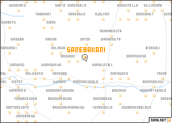
Saré Bakari (Kolda, Senegal)Saré Bakari is a town in the Kolda region of Senegal. An overview map of the region around Saré Bakari is displayed below.
regional and 3d topo map of Saré Bakari, Senegal ::
Saré Bakari airports ::
The nearest airport is ZIG - Ziguinchor, located 103.4 km south west of Saré Bakari.
Other airports nearby include KLC - Kaolack (103.5 km north), BJL - Banjul Intl (105.1 km west), CSK - Cap Skiring (150.5 km south west), BXO - Bissau Oswaldo Vieira Intl (153.6 km south), Nearby towns ::
Hamdalaye II (1.8km west) //
Dator (3.7km north) //
Boudouk (3.6km west) //
Diamalatiel (4.1km south east) //
Kaboél (5.2km south east) //
Banéba (5.2km south west) //
Saré Séni Dialo (5.6km south) //
Kandimba (5.8km south) //
Vélingara (5.7km west) //
Datorkouta (5.7km west) //
Koboel (6.6km south east) //
Boufara Gor (6.6km south east) //
Mansaba (6.6km south west) //
Diamakouta (6.6km north east) //
Diop Kounda (7.4km west) //
Missira (7.4km west) //
Ndiamakouta (7.8km north east) //
Djinani I (7.8km south west) //
Niafougne (8.1km south east) //
Madina (8.1km north west) //
Diaounar Doumou (9.2km south west) //
Badoumba Kéréouane (9.2km south west) //
Badindin (10.3km south east) //
Nioro (10.3km north west) //
[all distances 'as the bird flies' and approximate] 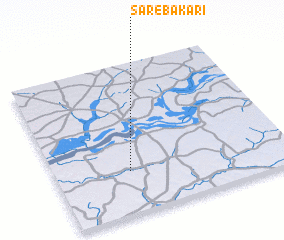 Places with similar names to Saré Bakari, Senegal ::
// Saré Bakari (SN)
// Saré Bakari (SN)
// Saré Bakoré (SN)
// Saré Bokari (SN)
// Sohrāb Kiria (PK)
// Sare Bakary (GM)
// Zawr Bakkūr (SY)
// Sare Bácar (GW)
Disclaimer :: Information on this page comes without warranty of any kind |
||
|
Where is Saré Bakari? Elevation and coordinates ::
Latitude (lat): 13°17'0"N Longitude (lon): 15°41'0"W
Elevation (approx.): 28m (map arrows pan, magnifying glasses zoom) |
||
|
Visiting Saré Bakari? Hotel/Accommodation ::
Book a hotel in Saré Bakari Travel Guide ::
Buy a travel guide for Senegal rental cars ::
car rental offers GPS waypoint ::
download a GPX waypoint (PoI) of Saré Bakari for your GPS receiver
|
||