|
search place name
|
||
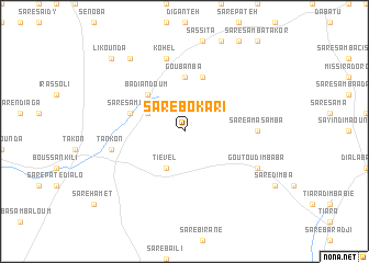
Saré Bokari (Kolda, Senegal)Saré Bokari is a town in the Kolda region of Senegal. An overview map of the region around Saré Bokari is displayed below.
regional and 3d topo map of Saré Bokari, Senegal ::
Saré Bokari airports ::
The nearest airport is KLC - Kaolack, located 118.1 km north west of Saré Bokari.
Other airports nearby include ZIG - Ziguinchor (121.1 km south west), BJL - Banjul Intl (132.3 km west), BXO - Bissau Oswaldo Vieira Intl (153.6 km south), CSK - Cap Skiring (171.1 km south west), Nearby towns ::
Saré Samba Kountéré (4.1km north west) //
Tiével (4.1km south west) //
Badiandoum (5.2km north west) //
Goubanba (5.6km north) //
Faragnima (5.8km north) //
Boussankili Ba (5.7km west) //
Saré Ama Samba (7.2km east) //
Kohel (7.6km north) //
Tankon (7.4km west) //
Goutou Dimba Ba (8.1km south east) //
Bambadala (9.2km north west) //
Li Kounda (10.3km north west) //
[all distances 'as the bird flies' and approximate]  Places with similar names to Saré Bokari, Senegal ::
// Saré Bakari (SN)
// Saré Bakari (SN)
// Saré Bakari (SN)
// Saré Bakoré (SN)
// Sohrāb Kiria (PK)
// Sare Bakary (GM)
// Zawr Bakkūr (SY)
// Sare Bácar (GW)
Disclaimer :: Information on this page comes without warranty of any kind |
||
|
Where is Saré Bokari? Elevation and coordinates ::
Latitude (lat): 13°16'0"N Longitude (lon): 15°26'0"W
Elevation (approx.): 41m (map arrows pan, magnifying glasses zoom) |
||
|
Visiting Saré Bokari? Hotel/Accommodation ::
Book a hotel in Saré Bokari Travel Guide ::
Buy a travel guide for Senegal rental cars ::
car rental offers GPS waypoint ::
download a GPX waypoint (PoI) of Saré Bokari for your GPS receiver
|
||