|
search place name
|
||
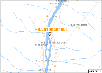
Hillat Wad Ramli (Al Kharţūm, Sudan)Hillat Wad Ramli is a town in the Al Kharţūm region of Sudan. An overview map of the region around Hillat Wad Ramli is displayed below.
regional and 3d topo map of Hillat Wad Ramli, Sudan ::
Hillat Wad Ramli airports ::
The nearest airport is KRT - Khartoum, located 56.9 km south of Hillat Wad Ramli.
Nearby towns ::
Wawissi (0.7km south) //
Hillat en Nikhela (2.3km north) //
Al Hakamab West (2.4km west) //
Wawissi Hillat esh Shekh ʼAli (3.6km south) //
Hillat el Wadi el Labyad (3.5km north west) //
Um Katti (4.1km west) //
Wawissi Hillat el Wadi (4.9km south east) //
Esh Shihenab (5.4km south west) //
Wawissi Hillat esh Shekh Abd el Qadir (6.2km south) //
Hillat el Bir (6.2km north) //
Wanna (6.4km north) //
Hillat Wad Mahamod (6.6km south west) //
Hillat Awlad Hamad (7.5km south west) //
Hillat Wad Abu Reda (7.7km north) //
Hillat ed Dom (7.8km south) //
Hillat es Sanaher (8.2km south west) //
Hillat Dabak (8.8km north) //
[all distances 'as the bird flies' and approximate] 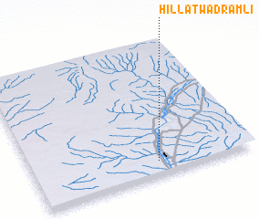 Places with similar names to Hillat Wad Ramli, Sudan :: Disclaimer :: Information on this page comes without warranty of any kind |
||
|
Where is Hillat Wad Ramli? Elevation and coordinates ::
Latitude (lat): 16°6'11"N Longitude (lon): 32°34'10"E
Elevation (approx.): 377m (map arrows pan, magnifying glasses zoom) |
||
|
Visiting Hillat Wad Ramli? Hotel/Accommodation ::
Book a hotel in Hillat Wad Ramli Travel Guide ::
Buy a travel guide for Sudan rental cars ::
car rental offers GPS waypoint ::
download a GPX waypoint (PoI) of Hillat Wad Ramli for your GPS receiver
|
||