|
search place name
|
||
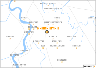
Raḩmānīyah ((( Al Wusţá )), Sudan)Raḩmānīyah is a town in the (( Al Wusţá )) region of Sudan. An overview map of the region around Raḩmānīyah is displayed below.
regional and 3d topo map of Raḩmānīyah, Sudan ::
Raḩmānīyah airports ::
The nearest airport is KRT - Khartoum, located 207.7 km north west of Raḩmānīyah.
Nearby towns ::
Al ‘Ubayd (2.6km south east) //
Munnaga (3.7km north) //
‘Amārat an Nefeidiya (4.1km north east) //
Al Quwayzāt (5.2km south west) //
‘Abd al Fāḑil (5.2km south east) //
‘Abd al Karīm (5.7km west) //
Doba (5.8km south) //
Ruḩaymāb (6.5km north west) //
Ḩasan al Ghazālī (6.6km south east) //
Nūrāb (6.6km north east) //
Beriab al Ḩujayr (7.2km west) //
Shudaydah (7.2km west) //
Nūr ad Dīn (7.4km west) //
Rayyāḩ (8.1km north west) //
[all distances 'as the bird flies' and approximate]  Places with similar names to Raḩmānīyah, Sudan ::
// Rumah Nyua (MY)
// Romonya (HU)
// Rumanya (BG)
// Raḩmānīyah (IQ)
// Raḩmānīyeh (IR)
// Raḩmānīyeh (IR)
// Raḩmānīyeh (IR)
// Rahmānīyeh (IR)
// Raḩmānīyah (SY)
// Remen'ye (RU)
Disclaimer :: Information on this page comes without warranty of any kind |
||
|
Where is Raḩmānīyah? Elevation and coordinates ::
Latitude (lat): 14°7'0"N Longitude (lon): 33°45'0"E
Elevation (approx.): 416m (map arrows pan, magnifying glasses zoom) |
||
|
Visiting Raḩmānīyah? Hotel/Accommodation ::
Book a hotel in Raḩmānīyah Travel Guide ::
Buy a travel guide for Sudan rental cars ::
car rental offers GPS waypoint ::
download a GPX waypoint (PoI) of Raḩmānīyah for your GPS receiver
|
||