|
search place name
|
||
Chimunsi (Eastern, Zambia)Chimunsi is a town in the Eastern region of Zambia. An overview map of the region around Chimunsi is displayed below.
regional and 3d topo map of Chimunsi, Zambia ::

Chimunsi airports ::
The nearest airport is MFU - Mfuwe, located 115.0 km north of Chimunsi.
Nearby towns ::
Jasi (1.9km north) //
Chipatala (1.8km west) //
Amoni (2.6km south west) //
Chalapuka (3.6km east) //
Ctha (4.1km north east) //
Nyambo (4.0km south west) //
Chiguya (5.2km north west) //
Kalaile (5.4km west) //
Kaudi (5.4km east) //
Chamoto (6.5km north west) //
Kavundala (6.6km north east) //
Mazyamba (7.4km south) //
Chakanga (7.6km north) //
Kambadya (7.4km east) //
Sindekani (8.2km north east) //
Chikungwa (8.1km north west) //
Kapika (9.2km north east) //
Aron (9.2km north west) //
Juma (9.2km south west) //
[all distances 'as the bird flies' and approximate] 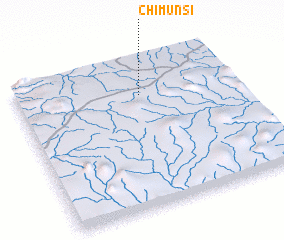 Places with similar names to Chimunsi, Zambia ::
// Chimeneas (ES)
// Shaw Mines (US)
// Shumans (US)
// Shimanzi (KE)
// Chimansa (ZM)
// Siamenso (ZM)
// Siamenso (ZM)
// Sīāh Mūnseh (IR)
// Shamanās (PK)
// Chimonzo (MZ)
Disclaimer :: Information on this page comes without warranty of any kind |
||
|
Where is Chimunsi? Elevation and coordinates ::
Latitude (lat): 14°14'0"S Longitude (lon): 31°34'0"E
Elevation (approx.): 1041m (map arrows pan, magnifying glasses zoom) |
||
|
Visiting Chimunsi? Hotel/Accommodation ::
Book a hotel in Chimunsi Travel Guide ::
Buy a travel guide for Zambia rental cars ::
car rental offers GPS waypoint ::
download a GPX waypoint (PoI) of Chimunsi for your GPS receiver
|
||