|
search place name
|
||
Siamenso (Western, Zambia)Siamenso is a town in the Western region of Zambia. An overview map of the region around Siamenso is displayed below.
regional and 3d topo map of Siamenso, Zambia ::

Siamenso airports ::
The nearest airport is BBK - Kasane, located 163.4 km south of Siamenso.
Other airports nearby include LVI - Livingstone (184.2 km south east), VFA - Victoria Falls Intl (211.9 km south east), Nearby towns ::
Matako (1.8km east) //
Samwenda (1.8km east) //
Samiwangu (1.9km north) //
Namutanja (1.8km east) //
Mabenga Kuta (1.8km east) //
Siansokonya (2.6km south east) //
Nunamila (2.6km south east) //
Mwanangombe (2.6km north east) //
Liavwaya (4.1km south east) //
Kabata (4.1km north east) //
Kambinja (4.1km north east) //
Nyungu (4.1km north east) //
Sibombo (5.6km south) //
Twambo (5.8km south) //
Mabenga (5.8km north) //
Simutonga (6.6km south west) //
Kapuma (7.6km south) //
Siloka (7.6km south) //
Libuku (7.7km south west) //
Sabazibi (8.2km south west) //
San Ala (8.2km north east) //
Chiasa (9.1km south west) //
[all distances 'as the bird flies' and approximate] 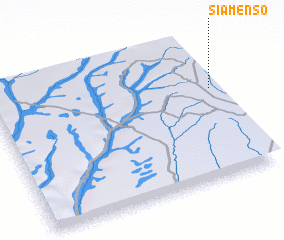 Places with similar names to Siamenso, Zambia ::
// Chimeneas (ES)
// Shaw Mines (US)
// Shumans (US)
// Shimanzi (KE)
// Chimansa (ZM)
// Chimunsi (ZM)
// Siamenso (ZM)
// Sīāh Mūnseh (IR)
// Shamanās (PK)
// Chimonzo (MZ)
Disclaimer :: Information on this page comes without warranty of any kind |
||
|
Where is Siamenso? Elevation and coordinates ::
Latitude (lat): 16°22'0"S Longitude (lon): 24°59'0"E
Elevation (approx.): 1127m (map arrows pan, magnifying glasses zoom) |
||
|
Visiting Siamenso? Hotel/Accommodation ::
Book a hotel in Siamenso Travel Guide ::
Buy a travel guide for Zambia rental cars ::
car rental offers GPS waypoint ::
download a GPX waypoint (PoI) of Siamenso for your GPS receiver
|
||