|
search place name
|
||
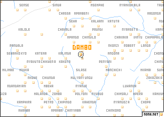
Dambo (Eastern, Zambia)Dambo is a town in the Eastern region of Zambia. An overview map of the region around Dambo is displayed below.
regional and 3d topo map of Dambo, Zambia ::
Dambo airports ::
The nearest airport is MFU - Mfuwe, located 119.8 km north of Dambo.
Other airports nearby include LLW - Lilongwe Kamuzu Intl (222.3 km east), TET - Tete Chingodzi (278.4 km south east), Nearby towns ::
Moyo (0.0km north) //
Njati (1.9km north) //
Kalinda (3.6km west) //
Silase (3.7km south) //
Mulungwe (3.7km south) //
Mposa (3.7km south) //
Chindilo (4.1km north east) //
Mpando (4.1km north west) //
Kakota (4.0km south west) //
Kawanga (5.2km north east) //
Chakuta (5.2km north east) //
Kanyumba (5.2km north east) //
Mulyanyungu (5.6km south) //
Kena (5.8km north) //
Penyani (5.7km east) //
Kaluwani (6.6km north east) //
Kalambila (6.6km north east) //
Paundi (6.6km north east) //
Chawala (6.6km north west) //
Chapuka (6.5km south east) //
Chinkumba (7.4km north) //
Katemo (7.4km north) //
Mngona (7.2km east) //
Chiwolela (7.2km west) //
Magona (7.2km east) //
Nyanje (7.4km south) //
Sewa (7.6km north) //
Nkonzi (7.4km east) //
Kalowa (7.6km south) //
[all distances 'as the bird flies' and approximate]  Places with similar names to Dambo, Zambia ::
Disclaimer :: Information on this page comes without warranty of any kind |
||
|
Where is Dambo? Elevation and coordinates ::
Latitude (lat): 14°20'0"S Longitude (lon): 31°48'0"E
Elevation (approx.): 1097m (map arrows pan, magnifying glasses zoom) |
||
|
Visiting Dambo? Hotel/Accommodation ::
Book a hotel in Dambo Travel Guide ::
Buy a travel guide for Zambia rental cars ::
car rental offers GPS waypoint ::
download a GPX waypoint (PoI) of Dambo for your GPS receiver
|
||