|
search place name
|
||
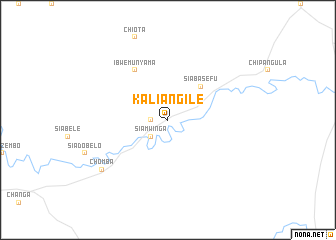
Kaliangile (Southern, Zambia)Kaliangile is a town in the Southern region of Zambia. An overview map of the region around Kaliangile is displayed below.
regional and 3d topo map of Kaliangile, Zambia ::
Kaliangile airports ::
The nearest airport is KAB - Kariba Intl, located 47.8 km south east of Kaliangile.
Other airports nearby include LUN - Lusaka Intl (98.8 km north), Nearby towns ::
Kalabaya (1.8km west) //
Siamwinga (2.6km south west) //
Ijamba School (2.6km north east) //
Siabasefu (5.1km north east) //
Ibwe Munyama (6.6km north west) //
Chomba (9.0km south west) //
[all distances 'as the bird flies' and approximate]  Places with similar names to Kaliangile, Zambia ::
// Klengel (DE)
// Gli Angeli (IT)
// Gli Angeli (IT)
// Kalınağıl (TR)
// Kaliangila (ZM)
// Kalunjele (ZM)
// Qelenjlū (IR)
// Kaliangile (NA)
// Klein-Agelo (NL)
// Glengyle (GB)
Disclaimer :: Information on this page comes without warranty of any kind |
||
|
Where is Kaliangile? Elevation and coordinates ::
Latitude (lat): 16°13'0"S Longitude (lon): 28°34'0"E
Elevation (approx.): 466m (map arrows pan, magnifying glasses zoom) |
||
|
Visiting Kaliangile? Hotel/Accommodation ::
Book a hotel in Kaliangile Travel Guide ::
Buy a travel guide for Zambia rental cars ::
car rental offers GPS waypoint ::
download a GPX waypoint (PoI) of Kaliangile for your GPS receiver
|
||