|
search place name
|
||
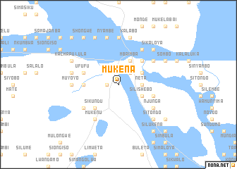
Mukena (Western, Zambia)Mukena is a town in the Western region of Zambia. An overview map of the region around Mukena is displayed below.
regional and 3d topo map of Mukena, Zambia ::
Nearby towns ::
Kalenga (1.8km west) //
Mulapani (2.6km north east) //
Papelo (2.6km north east) //
Neta (3.6km east) //
Mboo (3.6km east) //
Mwalie (3.6km east) //
Mundia (4.0km north east) //
Mutakela (4.0km north east) //
Muyungwa (4.0km north east) //
Kayatwa (4.0km north east) //
Kayanga (4.0km north east) //
Lyamupu (4.1km north east) //
Mbaimba (4.1km north east) //
Mandundu (4.1km north east) //
Silishebo (4.0km south east) //
Mungala (4.0km south east) //
Katongo (4.0km south east) //
Kalwizhi (5.2km north east) //
Sikundu (5.2km south west) //
Chipala (5.2km south west) //
Mwenekalunga (5.2km south west) //
Mpoko (5.4km west) //
Chimanya (5.4km west) //
Ufufu (5.7km west) //
Muyumbana (5.7km east) //
Namenda (6.6km north east) //
Noanga (6.6km north east) //
Masambo (6.5km north east) //
Chilunda (6.6km south west) //
[all distances 'as the bird flies' and approximate] 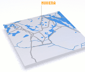 Places with similar names to Mukena, Zambia ::
Disclaimer :: Information on this page comes without warranty of any kind |
||
|
Where is Mukena? Elevation and coordinates ::
Latitude (lat): 15°2'0"S Longitude (lon): 22°40'0"E
Elevation (approx.): 1041m (map arrows pan, magnifying glasses zoom) |
||
|
Visiting Mukena? Hotel/Accommodation ::
Book a hotel in Mukena Travel Guide ::
Buy a travel guide for Zambia rental cars ::
car rental offers GPS waypoint ::
download a GPX waypoint (PoI) of Mukena for your GPS receiver
|
||