|
search place name
|
||
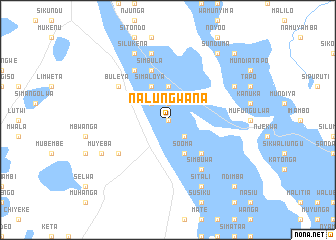
Nalungwana (Western, Zambia)Nalungwana is a town in the Western region of Zambia. An overview map of the region around Nalungwana is displayed below.
regional and 3d topo map of Nalungwana, Zambia ::
Nearby towns ::
Mwibawa (0.0km north) //
Lunenge (0.0km north) //
Sanyemba (0.0km north) //
Marumo (0.0km north) //
Sikwalo (1.9km north) //
Kaboma (1.9km north) //
Mutwati (1.9km north) //
Kakolokolo (1.9km north) //
Kalenga (1.9km north) //
Mwananyanda (1.9km north) //
Kabila (2.6km south east) //
Simioti (2.6km south east) //
Mwanamyanda (2.6km north west) //
Sikota (3.7km north) //
Mulitikita (3.7km north) //
Mumbili (3.7km north) //
Muyano (3.7km north) //
Mungole (4.1km south east) //
Sinyama (4.1km south east) //
Sooma (4.1km south east) //
Muveyeta (4.1km north west) //
Simaloya (4.1km north west) //
Inguu (4.1km north west) //
Sikapa (5.2km south east) //
Kangimbu (5.2km south east) //
Mungo (5.2km south east) //
Simbula (5.8km north) //
Kahema (5.8km north) //
Namasiku (6.6km south east) //
[all distances 'as the bird flies' and approximate] 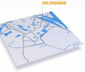 Places with similar names to Nalungwana, Zambia ::
Disclaimer :: Information on this page comes without warranty of any kind |
||
|
Where is Nalungwana? Elevation and coordinates ::
Latitude (lat): 15°10'0"S Longitude (lon): 22°45'0"E
Elevation (approx.): 1025m (map arrows pan, magnifying glasses zoom) |
||
|
Visiting Nalungwana? Hotel/Accommodation ::
Book a hotel in Nalungwana Travel Guide ::
Buy a travel guide for Zambia rental cars ::
car rental offers GPS waypoint ::
download a GPX waypoint (PoI) of Nalungwana for your GPS receiver
|
||