|
search place name
|
||
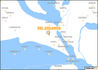
Nalungwana (Western, Zambia)Nalungwana is a town in the Western region of Zambia. An overview map of the region around Nalungwana is displayed below.
regional and 3d topo map of Nalungwana, Zambia ::
Nalungwana airports ::
The nearest airport is BBK - Kasane, located 271.4 km south east of Nalungwana.
Nearby towns ::
Mwala (0.0km north) //
Maimbolwa (0.0km north) //
Nalube (1.9km north) //
Mubita (3.7km north) //
Mwikisa (4.0km south east) //
Sitoti (4.1km south east) //
Mashewana (5.1km south east) //
Muzungu (5.1km north east) //
Mamba (5.1km north east) //
Kapui (5.3km east) //
Isilimwe (6.6km south west) //
Mukuli (6.6km south west) //
Kalongola (6.5km north east) //
Litaumbi (7.4km south) //
Nakatoia (7.4km east) //
Mukana (7.4km east) //
Mushondwa (7.7km south east) //
Isibebo (7.7km south east) //
Kamutumwa (8.0km south east) //
[all distances 'as the bird flies' and approximate] 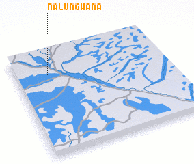 Places with similar names to Nalungwana, Zambia ::
Disclaimer :: Information on this page comes without warranty of any kind |
||
|
Where is Nalungwana? Elevation and coordinates ::
Latitude (lat): 16°16'0"S Longitude (lon): 23°12'0"E
Elevation (approx.): 1017m (map arrows pan, magnifying glasses zoom) |
||
|
Visiting Nalungwana? Hotel/Accommodation ::
Book a hotel in Nalungwana Travel Guide ::
Buy a travel guide for Zambia rental cars ::
car rental offers GPS waypoint ::
download a GPX waypoint (PoI) of Nalungwana for your GPS receiver
|
||