|
search place name
|
||
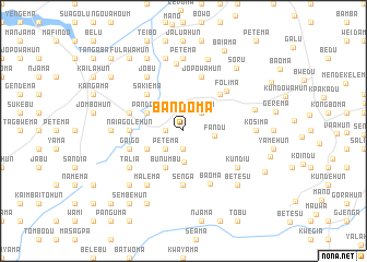
Bandoma (Eastern, Sierra Leone)Bandoma is a town in the Eastern region of Sierra Leone. An overview map of the region around Bandoma is displayed below.
regional and 3d topo map of Bandoma, Sierra Leone ::
Bandoma airports ::
The nearest airport is FAA - Faranah, located 201.8 km north of Bandoma.
Other airports nearby include MLW - Monrovia Spriggs Payne (217.2 km south), ROB - Monrovia Roberts Intl (221.5 km south), Nearby towns ::
Pejevulahun (1.9km south) //
Benoko (1.8km west) //
Balahun (2.4km north) //
Gerema (2.6km north east) //
Petema (2.6km south west) //
Nyandehun (3.2km south) //
Fandu (3.2km east) //
Bunumbu (4.1km south west) //
Mendekelema (4.1km south west) //
Nagbena (4.1km south west) //
Pandobu (4.1km north west) //
Panguma (5.2km north east) //
Gegbwema (5.2km north east) //
Sakiema (5.2km north west) //
Babahun (5.2km north west) //
Naiagolehun (5.5km west) //
Senga (5.6km south) //
Jopowahun (5.9km north) //
Gaigo (5.8km west) //
Buobobu (5.8km west) //
Folima (5.9km north east) //
Baoma (6.1km south east) //
Talia (6.6km south west) //
Kundiu (6.6km south east) //
Jobu (6.7km north west) //
Malema (6.7km south west) //
Baoma (6.9km north) //
Kosima (7.3km east) //
Bonjema (7.3km west) //
[all distances 'as the bird flies' and approximate] 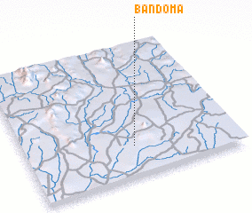 Places with similar names to Bandoma, Sierra Leone ::
// Bantam (US)
// Ban Ao Tom (TH)
// Ban Ao Udom (TH)
// Ban Dam (TH)
// Ban Diam (TH)
// Ban Domo (TH)
// Ban Dum (TH)
// Ban Na Doem (TH)
// Ban Na Ta Moe (TH)
// Ban Na Tom (TH)
Disclaimer :: Information on this page comes without warranty of any kind |
||
|
Where is Bandoma? Elevation and coordinates ::
Latitude (lat): 8°14'0"N Longitude (lon): 10°29'0"W
Elevation (approx.): 370m (map arrows pan, magnifying glasses zoom) |
||
|
Visiting Bandoma? Hotel/Accommodation ::
Book a hotel in Bandoma Travel Guide ::
rental cars ::
car rental offers GPS waypoint ::
download a GPX waypoint (PoI) of Bandoma for your GPS receiver
|
||