|
search place name
|
||
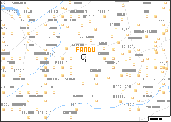
Fandu (Eastern, Sierra Leone)Fandu is a town in the Eastern region of Sierra Leone. An overview map of the region around Fandu is displayed below.
regional and 3d topo map of Fandu, Sierra Leone ::
Fandu airports ::
The nearest airport is FAA - Faranah, located 202.8 km north of Fandu.
Other airports nearby include MLW - Monrovia Spriggs Payne (217.1 km south), ROB - Monrovia Roberts Intl (220.9 km south), Nearby towns ::
Gerema (2.7km north west) //
Bandoma (3.2km west) //
Pejevulahun (3.5km south west) //
Kundiu (4.0km south east) //
Nyandehun (4.1km south west) //
Kosima (4.2km east) //
Gegbwema (4.2km north) //
Panguma (4.2km north) //
Folima (4.7km north) //
Dodo (4.8km north east) //
Balahun (4.9km north west) //
Baoma (5.0km south) //
Benoko (5.0km west) //
Petema (5.2km west) //
Betesu (5.6km south east) //
Bunumbu (6.0km south west) //
Mendekelema (6.0km south west) //
Senga (6.0km south west) //
Konia (6.0km east) //
Naiagolehun (6.0km east) //
Yamehun (6.1km east) //
Jopowahun (6.2km north) //
Dambalu (6.3km south east) //
Gerema (6.7km east) //
Nagbena (7.0km west) //
Soru (7.3km north) //
Pandobu (7.2km west) //
Sandialu (7.8km north) //
Guabu (7.9km north east) //
[all distances 'as the bird flies' and approximate]  Places with similar names to Fandu, Sierra Leone ::
Disclaimer :: Information on this page comes without warranty of any kind |
||
|
Where is Fandu? Elevation and coordinates ::
Latitude (lat): 8°13'44"N Longitude (lon): 10°27'16"W
Elevation (approx.): 357m (map arrows pan, magnifying glasses zoom) |
||
|
Visiting Fandu? Hotel/Accommodation ::
Book a hotel in Fandu Travel Guide ::
rental cars ::
car rental offers GPS waypoint ::
download a GPX waypoint (PoI) of Fandu for your GPS receiver
|
||