|
search place name
|
||
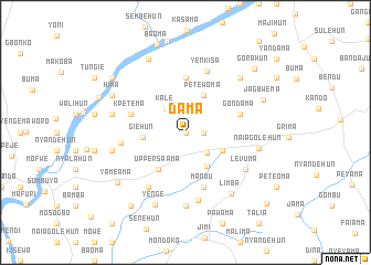
Dama (Southern, Sierra Leone)Dama is a town in the Southern region of Sierra Leone. An overview map of the region around Dama is displayed below.
regional and 3d topo map of Dama, Sierra Leone ::
Dama airports ::
The nearest airport is FNA - Freetown Lungi, located 181.1 km north west of Dama.
Other airports nearby include MLW - Monrovia Spriggs Payne (196.1 km south east), ROB - Monrovia Roberts Intl (229.6 km south east), Nearby towns ::
Bepi (0.0km north) //
Faiama (0.0km north) //
Kitoma (1.8km east) //
Bontiworo (3.0km south east) //
Kale (3.1km north west) //
Koadima (4.0km south east) //
Petewoma (4.1km north east) //
Mandehun (4.1km south east) //
Giehun (4.3km west) //
Upper Saama (4.6km south west) //
Bevehun (5.6km north) //
Mandu (5.9km south) //
Gondama (5.8km east) //
Kpetema (5.8km west) //
Yenkisa (6.5km north) //
Upper Benduma (6.6km west) //
Potobu (6.7km south west) //
Bandajuma (7.0km south) //
Levuma (7.1km south east) //
Mattru (7.4km south) //
Naiagolehun (7.6km east) //
Benduma (7.6km west) //
Powubu (7.6km west) //
Limba (7.7km south east) //
Bangoma (7.8km north east) //
Yenge (7.9km south west) //
Hima (8.2km north west) //
Segbwema (8.3km north west) //
Jagbwema (8.4km north east) //
[all distances 'as the bird flies' and approximate] 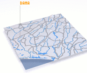 Places with similar names to Dama, Sierra Leone ::
Disclaimer :: Information on this page comes without warranty of any kind |
||
|
Where is Dama? Elevation and coordinates ::
Latitude (lat): 7°42'0"N Longitude (lon): 11°50'0"W
Elevation (approx.): 80m (map arrows pan, magnifying glasses zoom) |
||
|
Visiting Dama? Hotel/Accommodation ::
Book a hotel in Dama Travel Guide ::
rental cars ::
car rental offers GPS waypoint ::
download a GPX waypoint (PoI) of Dama for your GPS receiver
|
||