|
search place name
|
||
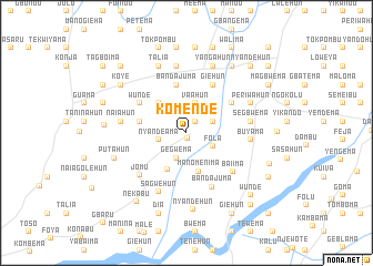
Komende (Eastern, Sierra Leone)Komende is a town in the Eastern region of Sierra Leone. An overview map of the region around Komende is displayed below.
regional and 3d topo map of Komende, Sierra Leone ::
Komende airports ::
The nearest airport is MLW - Monrovia Spriggs Payne, located 190.1 km south of Komende.
Other airports nearby include ROB - Monrovia Roberts Intl (206.9 km south), Nearby towns ::
Komende Luyama (0.5km south) //
Malehun (1.4km north east) //
Gegwema (2.7km south) //
Nyandeama (2.9km west) //
Majihun (2.9km north east) //
Fola (3.0km south east) //
Vaahun (3.1km north) //
Manomenima (4.1km south) //
Mano-Kotuhun (4.1km north west) //
Sami (4.2km south west) //
Gangama (4.8km west) //
Bongama (4.8km west) //
Bandajuma (4.9km north) //
Baoma (5.4km north east) //
Barve (5.5km north east) //
Giehun (5.5km north east) //
Wunde (5.5km north west) //
Bandajuma (6.0km south east) //
Baiima (6.1km south east) //
Jomu (6.3km south west) //
Buyama (6.4km east) //
Lago (6.5km east) //
Segbwema (6.5km east) //
Sagwehun (6.6km south west) //
Naiahun (6.6km west) //
Gerehun (6.6km west) //
Gaahun (6.8km north) //
Periwahun (7.0km north east) //
Yangahun (7.2km north) //
[all distances 'as the bird flies' and approximate] 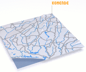 Places with similar names to Komende, Sierra Leone ::
Disclaimer :: Information on this page comes without warranty of any kind |
||
|
Where is Komende? Elevation and coordinates ::
Latitude (lat): 7°59'23"N Longitude (lon): 11°0'28"W
Elevation (approx.): 174m (map arrows pan, magnifying glasses zoom) |
||
|
Visiting Komende? Hotel/Accommodation ::
Book a hotel in Komende Travel Guide ::
rental cars ::
car rental offers GPS waypoint ::
download a GPX waypoint (PoI) of Komende for your GPS receiver
|
||