|
search place name
|
||
Kangunda (Malawi)Kangunda is a town in Malawi. An overview map of the region around Kangunda is displayed below.
regional and 3d topo map of Kangunda, Malawi ::

Kangunda airports ::
The nearest airport is LLW - Lilongwe Kamuzu Intl, located 58.7 km north west of Kangunda.
Other airports nearby include VXC - Lichinga (143.2 km north east), BLZ - Blantyre Chileka Intl (193.7 km south east), Nearby towns ::
Kyinge (0.0km north) //
Magenga (2.6km north east) //
Citundu (2.6km south east) //
Guma (4.0km south west) //
Ntambala (5.6km north) //
Nhokopo (5.7km east) //
Kafafwa (5.7km east) //
Nkalyapa (5.7km east) //
Kungungwe (6.5km south east) //
Tsogo (7.2km west) //
Konka (7.2km west) //
Gwengwe (8.1km north east) //
Mtemwende (8.2km south east) //
Napwanga (9.1km north east) //
Kaphuka (10.3km south west) //
[all distances 'as the bird flies' and approximate] 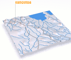 Places with similar names to Kangunda, Malawi ::
// Güneykǝnd (AZ)
// Köhnǝkǝnd (AZ)
// Cangandí (PA)
// Canquintú (PA)
// Kānī Kand (IQ)
// Kāwnagūnd (IQ)
// Kunegundow (PL)
// Güneykent (TR)
// Gunagunīt (ET)
// Gaon Kāndia (BD)
Disclaimer :: Information on this page comes without warranty of any kind |
||
|
Where is Kangunda? Elevation and coordinates ::
Latitude (lat): 14°5'0"S Longitude (lon): 34°14'0"E
Elevation (approx.): 1354m (map arrows pan, magnifying glasses zoom) |
||
|
Visiting Kangunda? Hotel/Accommodation ::
Book a hotel in Kangunda Travel Guide ::
Buy a travel guide for Malawi rental cars ::
car rental offers GPS waypoint ::
download a GPX waypoint (PoI) of Kangunda for your GPS receiver
|
||