|
search place name
|
||
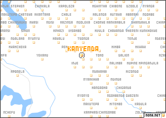
Kanyenda (Malawi)Kanyenda is a town in Malawi. An overview map of the region around Kanyenda is displayed below.
regional and 3d topo map of Kanyenda, Malawi ::
Kanyenda airports ::
The nearest airport is LLW - Lilongwe Kamuzu Intl, located 34.7 km south of Kanyenda.
Other airports nearby include VXC - Lichinga (155.1 km east), MFU - Mfuwe (208.7 km west), Nearby towns ::
Nthesa (0.0km north) //
Chiwilira (1.9km north) //
Chiweza (1.9km north) //
Gawati (1.9km south) //
Madzi (1.8km east) //
Kumbi (2.6km north east) //
Msumphi (2.6km north east) //
Mpamila (2.6km north west) //
Masinalo (2.6km south east) //
Inje (2.6km south west) //
Tomo (3.6km east) //
Jisoso (3.6km east) //
Tsonga (3.7km north) //
Dumea (4.1km north east) //
Pemba (4.1km north west) //
Chibisa (4.1km north west) //
Namatowo (4.1km south east) //
Agamonje (4.1km south east) //
Ndawambi (5.2km south east) //
Kisoso (5.4km east) //
Khuwi (5.6km north) //
Fitizalimba (5.6km north) //
Mpando (5.6km north) //
Kalinda (5.7km east) //
Visambo (5.8km north) //
Nyamkhwa (5.8km south) //
Kaphamtengo (5.8km south) //
Chaolamokanda (5.8km north) //
Kawenda (6.6km north east) //
[all distances 'as the bird flies' and approximate] 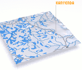 Places with similar names to Kanyenda, Malawi ::
// Canyon Day (US)
// Kounyentoou (BJ)
// Kanyèndé (BF)
// Kanyanda (UG)
// Kanyanda (ZM)
// Kanyanda (ZM)
// Kanyonda (ZM)
// Kunyanda (ZM)
// Guanyintai (CN)
// Qianyantou (CN)
Disclaimer :: Information on this page comes without warranty of any kind |
||
|
Where is Kanyenda? Elevation and coordinates ::
Latitude (lat): 13°29'0"S Longitude (lon): 33°51'0"E
Elevation (approx.): 1349m (map arrows pan, magnifying glasses zoom) |
||
|
Visiting Kanyenda? Hotel/Accommodation ::
Book a hotel in Kanyenda Travel Guide ::
Buy a travel guide for Malawi rental cars ::
car rental offers GPS waypoint ::
download a GPX waypoint (PoI) of Kanyenda for your GPS receiver
|
||