|
search place name
|
||
Afotobo (Cote d'Ivoire)Afotobo is a town in Cote d'Ivoire. An overview map of the region around Afotobo is displayed below.
regional and 3d topo map of Afotobo, Cote d'Ivoire ::

Afotobo airports ::
The nearest airport is BYK - Bouake, located 43.6 km east of Afotobo.
Other airports nearby include ASK - Yamoussoukro (86.0 km south), DJO - Daloa (148.1 km south west), HGO - Korhogo (189.7 km north), Nearby towns ::
Golikro (3.5km east) //
Akayakro (6.8km north west) //
Assékro (6.9km east) //
Bélakro (7.0km west) //
Assengou (7.0km west) //
Mangrékan (7.3km north) //
Alébla (7.6km east) //
Kaabo (7.8km south) //
Yakonamoun (8.6km south) //
Drimbo (8.6km north east) //
Koubébodan (9.3km north west) //
Diakoou (9.3km south west) //
Koumabo (9.4km south east) //
Akadiafoué (9.6km south west) //
Mbabo (10.8km south west) //
Kouadiokro (11.2km north east) //
Aounzé (11.5km north east) //
[all distances 'as the bird flies' and approximate] 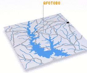 Places with similar names to Afotobo, Cote d'Ivoire ::
Disclaimer :: Information on this page comes without warranty of any kind |
||
|
Where is Afotobo? Elevation and coordinates ::
Latitude (lat): 7°40'29"N Longitude (lon): 5°27'50"W
Elevation (approx.): 284m (map arrows pan, magnifying glasses zoom) |
||
|
Visiting Afotobo? Hotel/Accommodation ::
Book a hotel in Afotobo Travel Guide ::
rental cars ::
car rental offers GPS waypoint ::
download a GPX waypoint (PoI) of Afotobo for your GPS receiver
|
||