|
search place name
|
||
Golikro (Cote d'Ivoire)Golikro is a town in Cote d'Ivoire. An overview map of the region around Golikro is displayed below.
regional and 3d topo map of Golikro, Cote d'Ivoire ::

Golikro airports ::
The nearest airport is BYK - Bouake, located 40.2 km east of Golikro.
Other airports nearby include ASK - Yamoussoukro (85.6 km south), DJO - Daloa (150.7 km south west), HGO - Korhogo (189.9 km north), Nearby towns ::
Assékro (3.4km east) //
Afotobo (3.5km west) //
Alébla (4.5km south east) //
Kouébo (5.5km east) //
Demakro (5.5km east) //
Drimbo (6.0km north east) //
Kaabo (7.3km south) //
Bouakro (7.3km east) //
Akapo (7.3km east) //
Koumabo (7.6km south) //
Mangrékan (7.9km north west) //
Lolobo (8.5km north east) //
Bodioussi (8.6km south east) //
Nangré (8.9km north east) //
Kouadiokro (9.5km north) //
Aounzé (9.6km north east) //
Akayakro (9.6km north west) //
Yakonamoun (10.0km south west) //
Saué (10.1km north east) //
Safoué-Diou (11.1km south east) //
[all distances 'as the bird flies' and approximate] 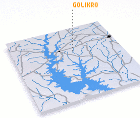 Places with similar names to Golikro, Cote d'Ivoire ::
// Kilgore (US)
// Calgro (US)
// Kelker (US)
// Kalkar (DE)
// Kalkar (DE)
// Kilgore (US)
// Kuala Kerai (MY)
// Kuala Kerau (MY)
// Kuala Kurau (MY)
// Calcara (IT)
Disclaimer :: Information on this page comes without warranty of any kind |
||
|
Where is Golikro? Elevation and coordinates ::
Latitude (lat): 7°40'29"N Longitude (lon): 5°25'57"W
Elevation (approx.): 280m (map arrows pan, magnifying glasses zoom) |
||
|
Visiting Golikro? Hotel/Accommodation ::
Book a hotel in Golikro Travel Guide ::
rental cars ::
car rental offers GPS waypoint ::
download a GPX waypoint (PoI) of Golikro for your GPS receiver
|
||