|
search place name
|
||
Atiégoakro (Cote d'Ivoire)Atiégoakro is a town in Cote d'Ivoire. An overview map of the region around Atiégoakro is displayed below.
regional and 3d topo map of Atiégoakro, Cote d'Ivoire ::

Atiégoakro airports ::
The nearest airport is BYK - Bouake, located 56.0 km north west of Atiégoakro.
Other airports nearby include ASK - Yamoussoukro (84.6 km south west), DJO - Daloa (200.6 km west), Nearby towns ::
Tiémélékro (5.1km south east) //
Essankouakoukro (5.2km east) //
Alubo (6.0km south) //
Diamankro (6.1km north) //
Bélakro (6.5km east) //
Koissi-Koissikro (7.3km east) //
Gbania-Gatakro (7.5km north east) //
Pouébo (7.7km south east) //
Salékro (7.8km north west) //
Ndiékro (8.0km north) //
Kon-Ngokro (8.4km north) //
Ndri-Kouadiokro (8.6km east) //
Tienbéléblakro (8.7km east) //
Kokoun-Koimikro (8.8km south west) //
Adiébo (9.1km south west) //
Landounou (9.1km north west) //
Kouassi-Nguessankro (9.3km south east) //
Bendé-Tanoukro (9.6km north west) //
Akanza-Kouadiokro (9.8km north east) //
Takikro (10.4km south west) //
Kouadio-Ndrikro (11.3km north east) //
[all distances 'as the bird flies' and approximate] 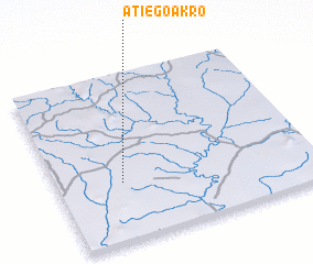 Places with similar names to Atiégoakro, Cote d'Ivoire ::
Disclaimer :: Information on this page comes without warranty of any kind |
||
|
Where is Atiégoakro? Elevation and coordinates ::
Latitude (lat): 7°21'9"N Longitude (lon): 4°44'45"W
Elevation (approx.): 194m (map arrows pan, magnifying glasses zoom) |
||
|
Visiting Atiégoakro? Hotel/Accommodation ::
Book a hotel in Atiégoakro Travel Guide ::
rental cars ::
car rental offers GPS waypoint ::
download a GPX waypoint (PoI) of Atiégoakro for your GPS receiver
|
||