|
search place name
|
||
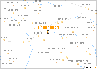
Kon-Ngokro (Cote d'Ivoire)Kon-Ngokro is a town in Cote d'Ivoire. An overview map of the region around Kon-Ngokro is displayed below.
regional and 3d topo map of Kon-Ngokro, Cote d'Ivoire ::
Kon-Ngokro airports ::
The nearest airport is BYK - Bouake, located 51.1 km north west of Kon-Ngokro.
Other airports nearby include ASK - Yamoussoukro (90.9 km south west), DJO - Daloa (204.8 km west), HGO - Korhogo (235.1 km north west), Nearby towns ::
Yaloukoukro (2.6km north) //
Diamankro (2.7km south west) //
Gbania-Gatakro (3.0km south east) //
Ndiékro (3.9km west) //
Kouassikro (4.5km north west) //
Akanza-Kouadiokro (5.6km east) //
Boandié (5.8km north east) //
Yéboué-Blessou (5.9km north west) //
Yaoblékro (7.2km north east) //
Kouadio-Ndrikro (7.3km east) //
Essankouakoukro (7.4km south east) //
Koimi-Konankro (7.5km north west) //
Salékro (7.6km west) //
Atiégoakro (8.4km south) //
Bélakro (8.6km south east) //
Tananou (9.0km north west) //
Tienbéléblakro (11.1km south east) //
[all distances 'as the bird flies' and approximate] 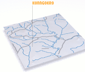 Places with similar names to Kon-Ngokro, Cote d'Ivoire ::
// Kunga-i Gawra (IQ)
// Kangkar (SG)
// Konkui Koura (BF)
// Kangkar (IN)
// Kangkuro (ID)
// Kongker (ID)
// Gangkiri (NG)
// Cangkorah (ID)
// Kong Kroh (VN)
// Kangkir (CN)
Disclaimer :: Information on this page comes without warranty of any kind |
||
|
Where is Kon-Ngokro? Elevation and coordinates ::
Latitude (lat): 7°25'36"N Longitude (lon): 4°43'54"W
Elevation (approx.): 217m (map arrows pan, magnifying glasses zoom) |
||
|
Visiting Kon-Ngokro? Hotel/Accommodation ::
Book a hotel in Kon-Ngokro Travel Guide ::
rental cars ::
car rental offers GPS waypoint ::
download a GPX waypoint (PoI) of Kon-Ngokro for your GPS receiver
|
||