|
search place name
|
||
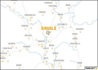
Siouolo (Cote d'Ivoire)Siouolo is a town in Cote d'Ivoire. An overview map of the region around Siouolo is displayed below.
regional and 3d topo map of Siouolo, Cote d'Ivoire ::
Siouolo airports ::
The nearest airport is SPY - San Pedro, located 102.6 km east of Siouolo.
Other airports nearby include DJO - Daloa (243.3 km north east), Nearby towns ::
Gimané (1.2km south west) //
Fété (1.3km north) //
Soklodougba (2.4km south) //
Kodeke (4.4km south west) //
Tiboto (4.6km south) //
Brétou (4.7km north east) //
Nyaake (4.9km south west) //
Baïro (5.2km south) //
New Road Town (5.2km south west) //
Kronowodoken (5.2km west) //
Gibsons Villa (5.4km south west) //
Soto Waté (6.0km north east) //
Gikla (6.3km south) //
Suwroken (7.4km west) //
Ouséto (7.8km south) //
Kaloke (7.9km west) //
Kodeke (2) (8.0km north west) //
Yadoke (8.1km north) //
Nouin (8.1km north east) //
Baoulo (8.2km north east) //
Podwé (8.5km south) //
Wutuke (8.6km north) //
Grabo (8.8km east) //
Tawake (9.1km north west) //
Gboweke (9.4km north west) //
Wregboken (9.6km north west) //
Wuduke (9.9km south west) //
Wortuke (10.1km south west) //
[all distances 'as the bird flies' and approximate] 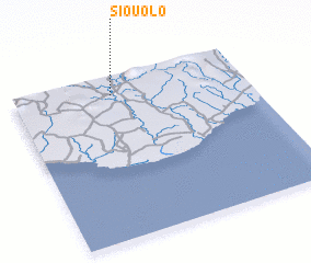 Places with similar names to Siouolo, Cote d'Ivoire ::
Disclaimer :: Information on this page comes without warranty of any kind |
||
|
Where is Siouolo? Elevation and coordinates ::
Latitude (lat): 4°53'22"N Longitude (lon): 7°34'28"W
Elevation (approx.): 49m (map arrows pan, magnifying glasses zoom) |
||
|
Visiting Siouolo? Hotel/Accommodation ::
Book a hotel in Siouolo Travel Guide ::
rental cars ::
car rental offers GPS waypoint ::
download a GPX waypoint (PoI) of Siouolo for your GPS receiver
|
||