|
search place name
|
||
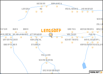
Lengdorf (Salzburg, Austria)Lengdorf is a town in the Salzburg region of Austria. An overview map of the region around Lengdorf is displayed below.
regional and 3d topo map of Lengdorf, Austria ::
nearby GPS traces from timatio ::
Lengdorf airports ::
The nearest airport is SZG - Salzburg, located 63.8 km north east of Lengdorf.
Other airports nearby include INN - Innsbruck (96.3 km west), OBF - Oberpfaffenhofen (133.8 km north west), MUC - Munich Munchen (134.3 km north west), BZO - Bolzano (134.3 km south west), Nearby towns ::
Hauptmannsdorf (0.0km north) //
Aisdorf (1.3km east) //
Steindorf (1.3km east) //
Hofham (1.9km north) //
Pölsen (2.2km north east) //
Niedernsill (2.5km east) //
Tobersbach (2.5km west) //
Uggl (2.5km west) //
Mühlbach (3.1km south east) //
Uttendorf (3.8km west) //
Köhlbichl (4.2km south west) //
Stubach (5.3km south west) //
Angerberg (5.0km east) //
Walchen (5.0km east) //
Litzldorf (5.0km west) //
Pirtendorf (5.0km west) //
Schattberg (5.4km east) //
Friedensbach (5.4km east) //
Gasteg (5.4km east) //
Fellern (7.5km south) //
[all distances 'as the bird flies' and approximate] 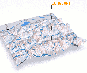 Places with similar names to Lengdorf, Austria ::
Disclaimer :: Information on this page comes without warranty of any kind |
||
|
Where is Lengdorf? Elevation and coordinates ::
Latitude (lat): 47°17'0"N Longitude (lon): 12°37'0"E
Elevation (approx.): 768m (map arrows pan, magnifying glasses zoom) |
||
|
Visiting Lengdorf? Hotel/Accommodation ::
Book a hotel in Lengdorf Travel Guide ::
Buy a travel guide for Austria rental cars ::
car rental offers GPS waypoint ::
download a GPX waypoint (PoI) of Lengdorf for your GPS receiver
|
||