|
search place name
|
||
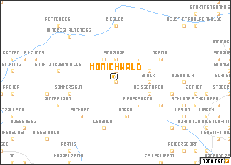
Mönichwald (Steiermark, Austria)Mönichwald is a town in the Steiermark region of Austria. An overview map of the region around Mönichwald is displayed below.
regional and 3d topo map of Mönichwald, Austria ::
nearby GPS traces from timatio ::
Mönichwald airports ::
The nearest airport is GRZ - Graz, located 60.4 km south west of Mönichwald.
Other airports nearby include VIE - Vienna Schwechat (90.4 km north east), MBX - Maribor (108.7 km south), BTS - Bratislava M R Stefanik (128.7 km north east), KLU - Klagenfurt (Worthersee Intl) (146.8 km south west), Nearby towns ::
Reifbach (0.0km north) //
Wetzelberg (1.9km north) //
Dörfl (1.9km north) //
Schrimpf (3.7km north) //
Breitenbrunn (3.9km north) //
Hintersberg (4.5km north east) //
Riegersbach (4.5km south east) //
Bruck (3.8km east) //
Vorau (5.7km south) //
Demmeldorf (4.2km north east) //
Weissenbach (4.2km south east) //
Sommersgut (5.3km west) //
Lembach (7.5km south) //
Sichart (6.7km south west) //
Greith (6.2km north east) //
Kottingsdorf (6.2km south east) //
Inneres Kaltenegg (8.9km north west) //
[all distances 'as the bird flies' and approximate] 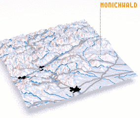 Places with similar names to Mönichwald, Austria ::
// Münchwald (DE)
Disclaimer :: Information on this page comes without warranty of any kind |
||
|
Where is Mönichwald? Elevation and coordinates ::
Latitude (lat): 47°27'0"N Longitude (lon): 15°52'0"E
Elevation (approx.): 584m (map arrows pan, magnifying glasses zoom) |
||
|
Visiting Mönichwald? Hotel/Accommodation ::
Book a hotel in Mönichwald Travel Guide ::
Buy a travel guide for Austria rental cars ::
car rental offers GPS waypoint ::
download a GPX waypoint (PoI) of Mönichwald for your GPS receiver
|
||