|
search place name
|
||
Ödenkirchen (Oberösterreich, Austria)Ödenkirchen is a town in the Oberösterreich region of Austria. An overview map of the region around Ödenkirchen is displayed below.
regional and 3d topo map of Ödenkirchen, Austria ::

Ödenkirchen airports ::
The nearest airport is LNZ - Linz (Horsching), located 50.5 km south east of Ödenkirchen.
Other airports nearby include SZG - Salzburg (116.9 km south west), PRG - Prague Ruzyne (163.3 km north), KLV - Karlovy Vary (187.4 km north), PED - Pardubice (201.3 km north east), Nearby towns ::
Zaglau (1.2km east) //
Unterthiergrub (1.2km west) //
Oberthiergrub (1.2km west) //
Kandlschlag (1.9km north) //
Kirchbach (1.9km south) //
Sankt Wolfgang (2.2km south east) //
Oberneudorf (2.2km south east) //
Stollnberg (2.2km north east) //
Stangl (2.2km north west) //
Lichtenberg (3.7km north) //
Hinterschlag (2.4km west) //
Haugsberg (3.9km south) //
Hintenberg (3.9km north) //
Stierberg (3.9km south) //
Kicking (3.9km south) //
Schindlau (3.1km north east) //
Salnau (3.9km north) //
Ulrichsberg (3.9km north) //
Vorderschlag (3.1km south west) //
Niederkramml (3.1km south west) //
Obergrünau (4.4km south east) //
Sonnleiten (4.4km north east) //
Peilstein im Mühlviertel (4.4km south west) //
Berdetschlag (4.4km north west) //
Diendorf (5.6km south) //
Rudolfing (3.7km east) //
Hochkramml (3.7km west) //
Salaberg (5.7km south) //
Oepping (5.7km south) //
[all distances 'as the bird flies' and approximate] 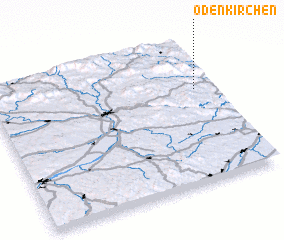 Places with similar names to Ödenkirchen, Austria ::
// Odenkirchen (DE)
Disclaimer :: Information on this page comes without warranty of any kind |
||
|
Where is Ödenkirchen? Elevation and coordinates ::
Latitude (lat): 48°39'0"N Longitude (lon): 13°55'0"E
Elevation (approx.): 710m (map arrows pan, magnifying glasses zoom) |
||
|
Visiting Ödenkirchen? Hotel/Accommodation ::
Book a hotel in Ödenkirchen Travel Guide ::
Buy a travel guide for Austria rental cars ::
car rental offers GPS waypoint ::
download a GPX waypoint (PoI) of Ödenkirchen for your GPS receiver
|
||