|
search place name
|
||
Ulrichsberg (Oberösterreich, Austria)Ulrichsberg is a town in the Oberösterreich region of Austria. An overview map of the region around Ulrichsberg is displayed below.
regional and 3d topo map of Ulrichsberg, Austria ::

Ulrichsberg airports ::
The nearest airport is LNZ - Linz (Horsching), located 54.4 km south east of Ulrichsberg.
Other airports nearby include SZG - Salzburg (119.2 km south west), PRG - Prague Ruzyne (159.8 km north), KLV - Karlovy Vary (183.5 km north), PED - Pardubice (199.3 km north east), Nearby towns ::
Salnau (0.0km north) //
Stangl (1.9km south) //
Lichtenberg (1.2km east) //
Berdetschlag (1.2km west) //
Pfaffetschlag (1.9km north) //
Kandlschlag (2.2km south east) //
Freundorf (2.2km north west) //
Hintenberg (2.4km east) //
Klaffer (2.4km west) //
Seitelschlag (2.4km west) //
Unterthiergrub (3.7km south) //
Oberthiergrub (3.7km south) //
Stollnberg (3.1km south east) //
Julbach (3.1km south west) //
Hinterschlag (3.9km south) //
Ödenkirchen (3.9km south) //
Zaglau (4.4km south east) //
Hochkramml (4.4km south west) //
Schönberg (4.4km north west) //
Sonnleiten (3.7km east) //
Bräuerau (3.7km west) //
Schindlau (4.1km south east) //
Sagberg (4.1km south west) //
Holzschlag (5.7km north) //
Schöneben (4.1km north east) //
Vorderanger (4.1km north west) //
Kirchbach (5.7km south) //
Niederkramml (5.7km south) //
Vorderschlag (5.7km south) //
[all distances 'as the bird flies' and approximate] 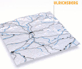 Places with similar names to Ulrichsberg, Austria ::
Disclaimer :: Information on this page comes without warranty of any kind |
||
|
Where is Ulrichsberg? Elevation and coordinates ::
Latitude (lat): 48°41'0"N Longitude (lon): 13°54'0"E
Elevation (approx.): 600m (map arrows pan, magnifying glasses zoom) |
||
|
Visiting Ulrichsberg? Hotel/Accommodation ::
Book a hotel in Ulrichsberg Travel Guide ::
Buy a travel guide for Austria rental cars ::
car rental offers GPS waypoint ::
download a GPX waypoint (PoI) of Ulrichsberg for your GPS receiver
|
||