|
search place name
|
||
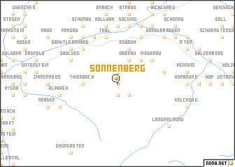
Sonnenberg (Tirol, Austria)Sonnenberg is a town in the Tirol region of Austria. An overview map of the region around Sonnenberg is displayed below.
regional and 3d topo map of Sonnenberg, Austria ::
Sonnenberg airports ::
The nearest airport is INN - Innsbruck, located 54.9 km west of Sonnenberg.
Other airports nearby include SZG - Salzburg (84.2 km north east), OBF - Oberpfaffenhofen (92.9 km north west), FEL - Fuerstenfeldbruck Furstenfeldbruck (104.8 km north west), MUC - Munich Munchen (105.8 km north), Nearby towns ::
Bernau (0.0km north) //
Mühlthal (1.9km north) //
Dorf (1.9km north) //
Auffach (1.9km south) //
Pechkaser (1.9km south) //
Schwarzenau (2.2km south east) //
Oberau (3.9km north) //
Haus (4.5km north east) //
Thierbach (3.8km west) //
Esbaum (5.7km north) //
Grafenweg (5.3km north east) //
Niederau (5.3km north east) //
Glatzham (7.5km north) //
Thal (7.5km north) //
Kropfrad (5.3km east) //
Kundl (6.7km north west) //
Liesfeld (7.8km north) //
Saulueg (6.2km north west) //
Wörgl (7.8km north) //
Kleinsöll (8.3km north west) //
Sankt Leonhard (7.5km north west) //
Breitenbach am Inn (8.9km north west) //
Ramsau (8.9km north west) //
Wörgler Boden (8.9km north east) //
Langer Grund (8.8km south east) //
[all distances 'as the bird flies' and approximate]  Places with similar names to Sonnenberg, Austria ::
// Sonnenberg (AT)
// Sonnenberg (AT)
// Sonnenberg (DE)
// Sonnenberg (DE)
// Sonnenberg (DE)
// Sonnenberg (DE)
// Sonnenberg (DE)
// Sonnenberg (DE)
// Sonnenberg (DE)
// Sonnenberg (DE)
Disclaimer :: Information on this page comes without warranty of any kind |
||
|
Where is Sonnenberg? Elevation and coordinates ::
Latitude (lat): 47°25'0"N Longitude (lon): 12°2'0"E
Elevation (approx.): 825m (map arrows pan, magnifying glasses zoom) |
||
|
Visiting Sonnenberg? Hotel/Accommodation ::
Book a hotel in Sonnenberg Travel Guide ::
Buy a travel guide for Austria rental cars ::
car rental offers GPS waypoint ::
download a GPX waypoint (PoI) of Sonnenberg for your GPS receiver
|
||