|
search place name
|
||
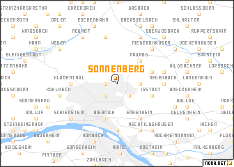
Sonnenberg (Hessen, Germany)Sonnenberg is a town in the Hessen region of Germany. An overview map of the region around Sonnenberg is displayed below.
regional and 3d topo map of Sonnenberg, Germany ::
Sonnenberg airports ::
The nearest airport is FRA - Frankfurt Main, located 21.4 km east of Sonnenberg.
Other airports nearby include ZNF - Hanau Aaf (50.3 km east), ZNV - Koblenz Winningen (58.3 km north west), MHG - Mannheim City (72.0 km south), HHN - Frankfurt Hahn (73.8 km west), Nearby towns ::
Eigenheim (1.2km west) //
Rambach (1.9km north) //
Bierstadt (2.2km south east) //
Wiesbaden (2.2km south west) //
Kloppenheim (2.4km east) //
Heßloch (3.0km north east) //
Naurod (4.4km north east) //
Igstadt (4.0km south east) //
Auringen (4.0km north east) //
Biebrich (5.7km south) //
Erbenheim (6.0km south east) //
Medenbach (4.8km east) //
Amöneburg (7.4km south) //
Klarenthal (4.8km west) //
Am Roten Berg (5.1km east) //
Engenhahn (7.5km north) //
Niedernhausen (6.6km north east) //
Königshofen (7.8km north) //
Kastel (7.8km south) //
Neuhof (8.2km north west) //
Mechtildshausen (8.2km south east) //
Schierstein (7.3km south west) //
Oberjosbach (8.8km north east) //
[all distances 'as the bird flies' and approximate] 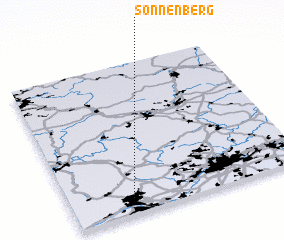 Places with similar names to Sonnenberg, Germany ::
// Sonnenberg (AT)
// Sonnenberg (AT)
// Sonnenberg (AT)
// Sonnenberg (DE)
// Sonnenberg (DE)
// Sonnenberg (DE)
// Sonnenberg (DE)
// Sonnenberg (DE)
// Sonnenberg (DE)
// Sonnenberg (DE)
Disclaimer :: Information on this page comes without warranty of any kind |
||
|
Where is Sonnenberg? Elevation and coordinates ::
Latitude (lat): 50°6'0"N Longitude (lon): 8°16'0"E
Elevation (approx.): 195m (map arrows pan, magnifying glasses zoom) |
||
|
Visiting Sonnenberg? Hotel/Accommodation ::
Book a hotel in Sonnenberg Travel Guide ::
Buy a travel guide for Germany rental cars ::
car rental offers GPS waypoint ::
download a GPX waypoint (PoI) of Sonnenberg for your GPS receiver
|
||