|
search place name
|
||
Aigis (Bayern, Germany)Aigis is a town in the Bayern region of Germany. An overview map of the region around Aigis is displayed below.
regional and 3d topo map of Aigis, Germany ::

Aigis airports ::
The nearest airport is ACH - St Gallen Altenrhein, located 42.6 km west of Aigis.
Other airports nearby include FDH - Friedrichshafen (44.9 km west), INN - Innsbruck (101.2 km east), OBF - Oberpfaffenhofen (103.5 km north east), FEL - Fuerstenfeldbruck Furstenfeldbruck (110.2 km north east), Nearby towns ::
Wiederhofen (0.0km north) //
Missen-Wilhams (1.2km east) //
Geratsried (2.5km west) //
Missen (2.5km east) //
Berg (2.5km east) //
Wiedemannsdorf (3.7km south) //
Sibratshofen (3.9km north) //
Hub (3.9km south) //
Oberried (4.5km north west) //
Reuter (4.5km south east) //
Ratholz (4.5km south east) //
Osterdorf (5.6km south) //
Pfarrenberg (4.2km north west) //
Schüttentobel (4.2km north west) //
Trabers (4.2km south west) //
Börlas (4.2km north east) //
Thalkirchdorf (5.7km south) //
Konstanzer (5.7km south) //
Lamprechts (5.7km south) //
Hohenegg (5.3km north west) //
Gerholz (5.3km north east) //
Weitnau (6.1km north east) //
Tronsberg (5.3km south west) //
Hintersee (5.3km south east) //
Knechtenhofen (6.1km south west) //
Salmas (6.1km south west) //
Nellenberg (7.4km north) //
Gerstland (5.0km west) //
Kleinweiler (7.4km north) //
[all distances 'as the bird flies' and approximate] 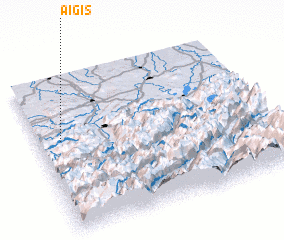 Places with similar names to Aigis, Germany ::
Disclaimer :: Information on this page comes without warranty of any kind |
||
|
Where is Aigis? Elevation and coordinates ::
Latitude (lat): 47°36'0"N Longitude (lon): 10°6'0"E
Elevation (approx.): 1105m (map arrows pan, magnifying glasses zoom) |
||
|
Visiting Aigis? Hotel/Accommodation ::
Book a hotel in Aigis Travel Guide ::
Buy a travel guide for Germany rental cars ::
car rental offers GPS waypoint ::
download a GPX waypoint (PoI) of Aigis for your GPS receiver
|
||