|
search place name
|
||
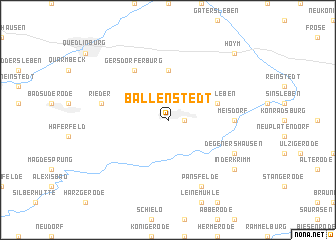
Ballenstedt (Sachsen-Anhalt, Germany)Ballenstedt is a town in the Sachsen-Anhalt region of Germany. An overview map of the region around Ballenstedt is displayed below.
regional and 3d topo map of Ballenstedt, Germany ::
Ballenstedt airports ::
The nearest airport is LEJ - Leipzig Halle, located 76.7 km south east of Ballenstedt.
Other airports nearby include BWE - Braunschweig Wolfsburg (81.6 km north west), ERF - Erfurt (84.2 km south), AOC - Altenburg Nobitz (120.6 km south east), ZCN - Celle (127.8 km north west), Nearby towns ::
Opperode (1.1km east) //
Badeborn (5.6km north) //
Radisleben (3.9km north east) //
Gersdorfer Burg (6.0km north) //
Meisdorf (4.6km east) //
Rieder (5.0km west) //
Pansfelde (7.8km south) //
Degenershausen (5.9km south east) //
In der Krimm (7.2km south east) //
Hoym (8.7km north east) //
[all distances 'as the bird flies' and approximate] 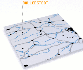 Places with similar names to Ballenstedt, Germany ::
// Bullenstedt (DE)
Disclaimer :: Information on this page comes without warranty of any kind |
||
|
Where is Ballenstedt? Elevation and coordinates ::
Latitude (lat): 51°43'0"N Longitude (lon): 11°14'0"E
Elevation (approx.): 233m (map arrows pan, magnifying glasses zoom) |
||
|
Visiting Ballenstedt? Hotel/Accommodation ::
Book a hotel in Ballenstedt Travel Guide ::
Buy a travel guide for Germany rental cars ::
car rental offers GPS waypoint ::
download a GPX waypoint (PoI) of Ballenstedt for your GPS receiver
|
||