|
search place name
|
||
Bullenstedt (Sachsen-Anhalt, Germany)Bullenstedt is a town in the Sachsen-Anhalt region of Germany. An overview map of the region around Bullenstedt is displayed below.
regional and 3d topo map of Bullenstedt, Germany ::

Bullenstedt airports ::
The nearest airport is LEJ - Leipzig Halle, located 55.8 km south east of Bullenstedt.
Other airports nearby include BWE - Braunschweig Wolfsburg (96.7 km north west), ERF - Erfurt (102.1 km south west), AOC - Altenburg Nobitz (106.6 km south east), TXL - Berlin Tegel (140.6 km north east), Nearby towns ::
Ilberstedt (1.9km north) //
Aderstedt (2.2km south east) //
Cölbigk (2.2km north west) //
Gröna (2.9km south east) //
Plötzkau (3.9km south) //
Bründel (3.9km south) //
Rathmannsdorf (4.4km north west) //
Neuborna (3.4km east) //
Osmarsleben (3.4km west) //
Waldau (3.9km north east) //
Beesedau (6.0km south) //
Großwirschleben (6.0km south) //
Güsten (4.6km west) //
Poplitz (7.5km south) //
Bernburg (4.9km east) //
Amesdorf (4.9km west) //
Hohenerxleben (7.5km north) //
Kustrena (6.5km south east) //
Beesenlaublingen (7.8km south) //
Neugattersleben (7.8km north) //
Schackstedt (8.2km south west) //
[all distances 'as the bird flies' and approximate] 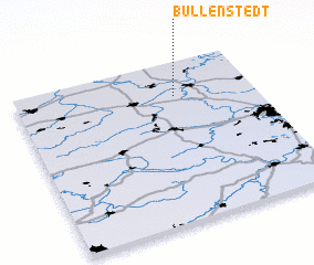 Places with similar names to Bullenstedt, Germany ::
// Ballenstedt (DE)
Disclaimer :: Information on this page comes without warranty of any kind |
||
|
Where is Bullenstedt? Elevation and coordinates ::
Latitude (lat): 51°47'0"N Longitude (lon): 11°40'0"E
Elevation (approx.): 104m (map arrows pan, magnifying glasses zoom) |
||
|
Visiting Bullenstedt? Hotel/Accommodation ::
Book a hotel in Bullenstedt Travel Guide ::
Buy a travel guide for Germany rental cars ::
car rental offers GPS waypoint ::
download a GPX waypoint (PoI) of Bullenstedt for your GPS receiver
|
||